File:Principatus Silesiae Bregensis.jpg
Jump to navigation
Jump to search

Size of this preview: 800 × 561 pixels. Other resolutions: 320 × 224 pixels | 640 × 449 pixels | 1,024 × 718 pixels | 1,280 × 898 pixels | 2,560 × 1,796 pixels | 10,390 × 7,289 pixels.
Original file (10,390 × 7,289 pixels, file size: 16.69 MB, MIME type: image/jpeg)
Captions
Captions
Add a one-line explanation of what this file represents
Summary
[edit]
| Description |
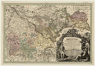
English: Map of the historical Duchy of Brzeg from the 18th century Deutsch: Karte des historischen Herzogtums Brieg aus dem 18. Jahrhundert Čeština: Mapa historického Břežského knížectví ze 18. století Polski: Mapa historycznego księstwa brzeskiego z XVIII wieku |
| Date | |
| Source | gallica.bnf.fr / Bibliothèque nationale de France |
| Author | Johann Wolfgang Wieland, Matthäus von Schubarth |
Licensing
[edit]
|
This work is in the public domain in its country of origin and other countries and areas where the copyright term is the author's life plus 70 years or fewer. This work is in the public domain in the United States because it was published (or registered with the U.S. Copyright Office) before January 1, 1929. | |
| This file has been identified as being free of known restrictions under copyright law, including all related and neighboring rights. | |
File history
Click on a date/time to view the file as it appeared at that time.
| Date/Time | Thumbnail | Dimensions | User | Comment | |
|---|---|---|---|---|---|
| current | 17:35, 15 July 2020 | | 10,390 × 7,289 (16.69 MB) | Rumpyk (talk | contribs) | == {{int:filedesc}} == {{Information |description={{en|Map of the historical Duchy of Brzeg from the 18th century}}{{de|Karte des historischen Herzogtums Brieg aus dem 18. Jahrhundert}}{{cs|Mapa historického Břežského knížectví ze 18. století}}{{pl|Mapa historycznego księstwa brzeskiego z XVIII wieku}} |date=1736 |source=[https://gallica.bnf.fr/ark:/12148/btv1b53039090z gallica.bnf.fr] / Bibliothèque nationale de France |author=Johann Wolfgang Wieland, Matthäus von Schubarth |permission= |oth... |
You cannot overwrite this file.
File usage on Commons
There are no pages that use this file.
File usage on other wikis
The following other wikis use this file:
- Usage on de.wikipedia.org