File:Progreso and Merida satellite image.jpg
Jump to navigation
Jump to search
Size of this preview: 600 × 600 pixels. Other resolutions: 240 × 240 pixels | 480 × 480 pixels | 768 × 768 pixels | 1,024 × 1,024 pixels | 2,048 × 2,048 pixels | 3,600 × 3,600 pixels.
Original file (3,600 × 3,600 pixels, file size: 5.08 MB, MIME type: image/jpeg)
Captions
Captions
Add a one-line explanation of what this file represents
Summary[edit]
| Description |
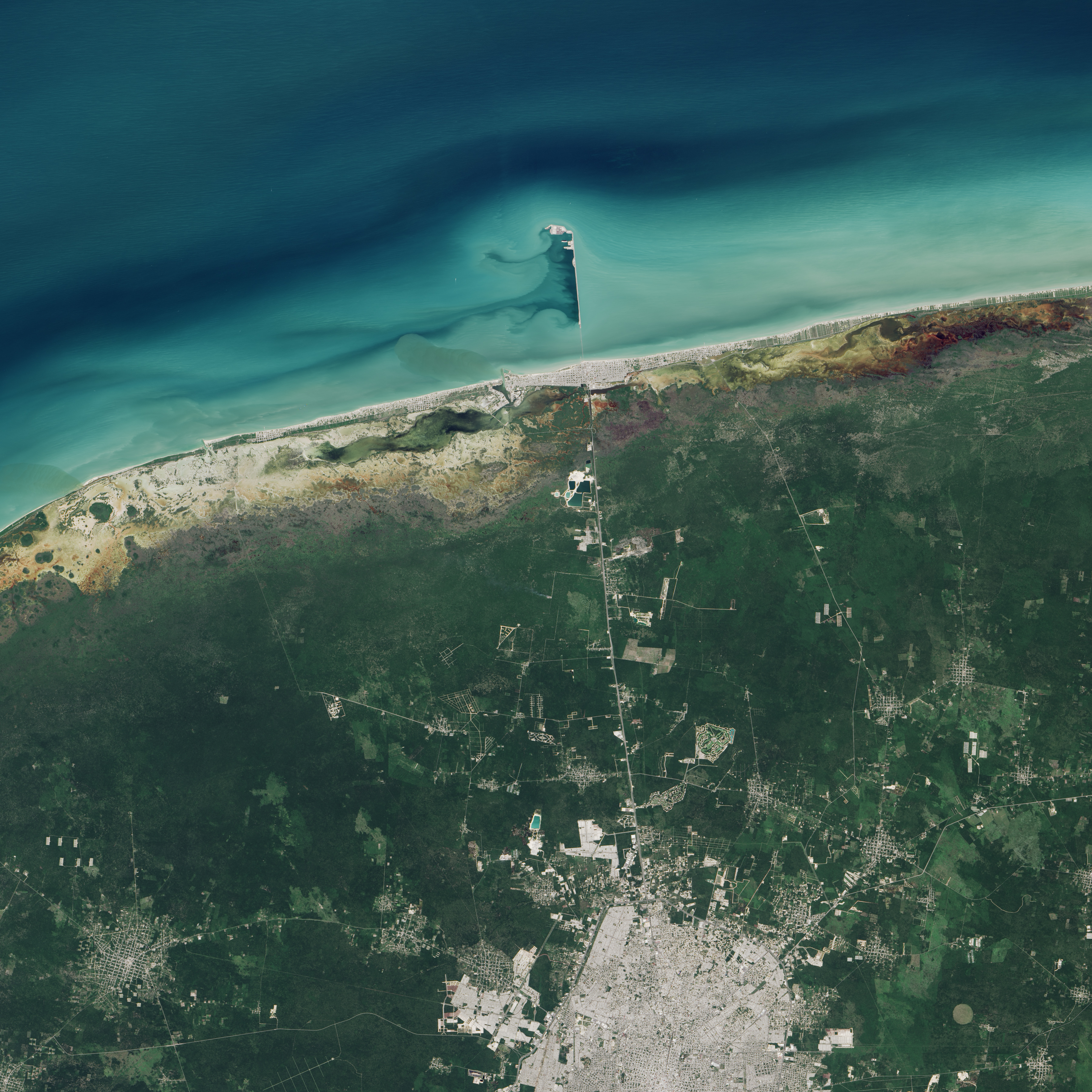
English: The Operational Land Imager (OLI) on Landsat 8 captured this image of Progreso's pier on November 5, 2014. According to Gabriela García-Rubio of the Ensenada Center for Scientific Research and Higher Education, light turquoise areas offshore are probably shallower than the darker areas. Prevailing winds here typically blow from the east-northeast, producing short-period waves and carrying sediment westward along the shore. |
| Date | |
| Source | Earth Viewed by Landsat 8 |
| Author | NASA |
Licensing[edit]
| This file is in the public domain in the United States because it was solely created by NASA. NASA copyright policy states that "NASA material is not protected by copyright unless noted". (See Template:PD-USGov, NASA copyright policy page or JPL Image Use Policy.) | ||
 |
Warnings:
|
| Annotations | This image is annotated: View the annotations at Commons |
File history
Click on a date/time to view the file as it appeared at that time.
| Date/Time | Thumbnail | Dimensions | User | Comment | |
|---|---|---|---|---|---|
| current | 21:03, 1 August 2015 | | 3,600 × 3,600 (5.08 MB) | Jmagno1998 (talk | contribs) | User created page with UploadWizard |
You cannot overwrite this file.
File usage on Commons
There are no pages that use this file.
File usage on other wikis
The following other wikis use this file:
- Usage on es.wikipedia.org