File:Provincia de Yauli.png
Jump to navigation
Jump to search

Size of this preview: 800 × 519 pixels. Other resolutions: 320 × 208 pixels | 640 × 415 pixels | 908 × 589 pixels.
Original file (908 × 589 pixels, file size: 88 KB, MIME type: image/png)
Captions
Captions
Add a one-line explanation of what this file represents
Summary[edit]
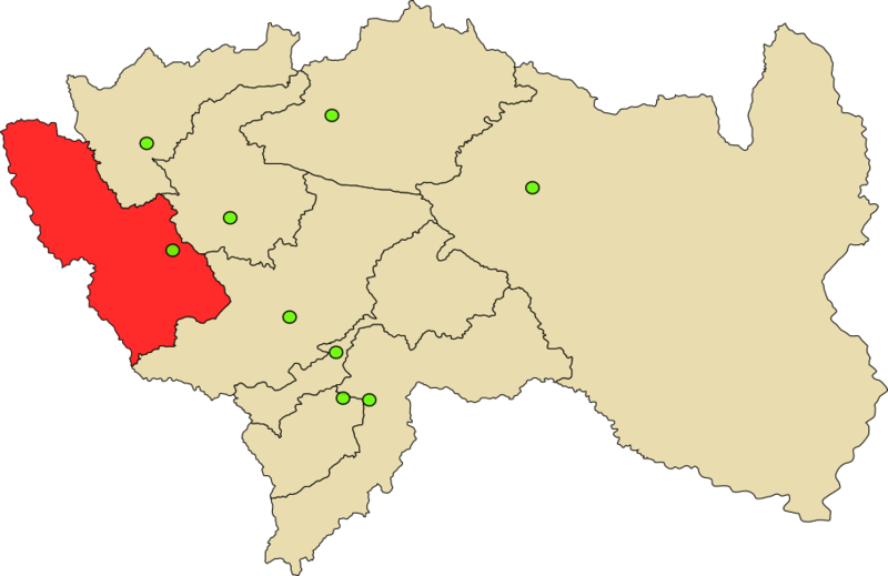
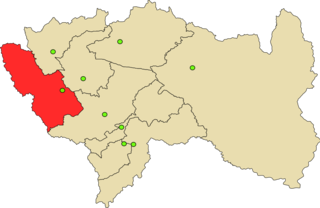
| Description | Mapa de Provincia de Yauli en Perú |
| Date | |
| Source | my |
| Author | Hugo.arg |
Licensing[edit]
I, the copyright holder of this work, hereby publish it under the following licenses:

|
Permission is granted to copy, distribute and/or modify this document under the terms of the GNU Free Documentation License, Version 1.2 or any later version published by the Free Software Foundation; with no Invariant Sections, no Front-Cover Texts, and no Back-Cover Texts. A copy of the license is included in the section entitled GNU Free Documentation License. |
This file is licensed under the Creative Commons Attribution-Share Alike 4.0 International, 3.0 Unported, 2.5 Generic, 2.0 Generic and 1.0 Generic license.
- You are free:
- to share – to copy, distribute and transmit the work
- to remix – to adapt the work
- Under the following conditions:
- attribution – You must give appropriate credit, provide a link to the license, and indicate if changes were made. You may do so in any reasonable manner, but not in any way that suggests the licensor endorses you or your use.
- share alike – If you remix, transform, or build upon the material, you must distribute your contributions under the same or compatible license as the original.
You may select the license of your choice.
File history
Click on a date/time to view the file as it appeared at that time.
| Date/Time | Thumbnail | Dimensions | User | Comment | |
|---|---|---|---|---|---|
| current | 12:47, 11 February 2008 | | 908 × 589 (88 KB) | Hugo.arg (talk | contribs) | {{Information |Description=Mapa de Provincia de Yauli en Perú |Source=my |Date=2008 |Author=~~~ |Permission=see bellow |other_versions= }} Category:Maps of Peru |
You cannot overwrite this file.
File usage on Commons
The following 2 pages use this file:
File usage on other wikis
The following other wikis use this file:
- Usage on ay.wikipedia.org
- Yawli jisk'a suyu
- Uruya jisk'a t'aqa suyu
- Chakapalpa jisk'a t'aqa suyu
- Markapumaqucha jisk'a t'aqa suyu
- Muruqucha jisk'a t'aqa suyu
- Qarwaqayan jisk'a t'aqa suyu
- Santa Rosa Saqu jisk'a t'aqa suyu
- Suytukancha jisk'a t'aqa suyu
- Way Way jisk'a t'aqa suyu
- Yawli jisk'a t'aqa suyu
- Phaqcha (Yawli) jisk'a t'aqa suyu
- Usage on de.wikipedia.org
- Usage on en.wikipedia.org
- Usage on es.wikipedia.org
- Provincia de Yauli
- Distrito de La Oroya
- Distrito de Santa Bárbara de Carhuacayán
- Distrito de Suitucancha
- Distrito de Paccha (Yauli)
- Distrito de Chacapalpa
- Distrito de Marcapomacocha
- Distrito de Huayhuay
- Departamento de Junín
- Distrito de Yauli (Yauli)
- Distrito de Santa Rosa de Sacco
- Elecciones regionales de Junín de 2014
- Elecciones regionales de Junín de 2010
- Gobierno Regional de Junín
- Usage on fa.wikipedia.org
- Usage on fr.wikipedia.org
- Usage on ia.wikipedia.org
- Usage on it.wikipedia.org
- Usage on ka.wikipedia.org
- Usage on lt.wikipedia.org
- Usage on nl.wikipedia.org
- Usage on pl.wikipedia.org
- Usage on pt.wikipedia.org
View more global usage of this file.