File:Putnam County Illinois 1831.png
跳至導覽
跳至搜尋
無更高解析度可提供。
Putnam_County_Illinois_1831.png (288 × 405 像素,檔案大小:9 KB,MIME 類型:image/png)
說明
說明
添加單行說明來描述出檔案所代表的內容
| 描述 |
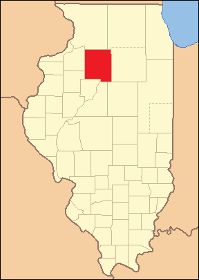
Locator Map of Putnam County, Illinois, 1831-1837. Based on: Illinois Secretary of State. Origin and Evolution of Illinois Counties. 2010. p. 52. http://www.cyberdriveillinois.com/publications/pdf_publications/ipub15.pdf |
| 日期 | (UTC) |
| 來源 | |
| 作者 |
|
我,本作品的著作權持有者,決定用以下授權條款發佈本作品:
此檔案採用創用CC 姓名標示-相同方式分享 2.5 通用版授權條款。
- 您可以自由:
- 分享 – 複製、發佈和傳播本作品
- 重新修改 – 創作演繹作品
- 惟需遵照下列條件:
- 姓名標示 – 您必須指名出正確的製作者,和提供授權條款的連結,以及表示是否有對內容上做出變更。您可以用任何合理的方式來行動,但不得以任何方式表明授權條款是對您許可或是由您所使用。
- 相同方式分享 – 如果您利用本素材進行再混合、轉換或創作,您必須基於如同原先的相同或兼容的條款,來分布您的貢獻成品。
| 此檔案採用創用CC 姓名標示-相同方式分享 3.0 未在地化版本授權條款。 | ||
| ||
| 已新增授權條款標題至此檔案,作為GFDL授權更新的一部份。 |

|
已授權您依據自由軟體基金會發行的無固定段落、封面文字和封底文字GNU自由文件授權條款1.2版或任意後續版本,對本檔進行複製、傳播和/或修改。該協議的副本列在GNU自由文件授權條款中。 |
您可以選擇您需要的授權條款。
This image or file is a work of a United States Census Bureau employee, taken or made as part of that person's official duties. As a work of the U.S. federal government, the image is in the public domain.
|
 |
原始上傳日誌
[編輯]
This image is a derivative work of the following images:
- File:Illinois_Locator_Map.PNG licensed with Cc-by-sa-2.5, Cc-by-sa-3.0-migrated, GFDL, PD-USGov-DOC-Census
- 2007-04-25T04:02:40Z Ruhrfisch 288x405 (12719 Bytes) {{Information| |Description= Locator Map of Illinois, United States |Source= taken from US Census website [http://factfinder.census.gov/] and modified by [[User:Ruhrfisch]] |Date= March 2007 |Author= US Census, Ruhrfisch |Pe
- 2007-03-28T03:45:05Z Ruhrfisch 288x405 (12872 Bytes) {{Information| |Description= Locator Map of Illinois, United States |Source= taken from US Census website [http://factfinder.census.gov/] and modified by [[User:Ruhrfisch]] |Date= March 2007 |Author= US Census, Ruhrfisch |Pe
- 2007-03-28T03:12:42Z Ruhrfisch 242x412 (11353 Bytes) {{Information| |Description= Locator Map of Illinois, United States |Source= taken from US Census website [http://factfinder.census.gov/] and modified by [[User:Ruhrfisch]] |Date= March 2007 |Author= US Census, Ruhrfisch |Pe
Uploaded with derivativeFX
檔案歷史
點選日期/時間以檢視該時間的檔案版本。
| 日期/時間 | 縮圖 | 尺寸 | 使用者 | 備註 | |
|---|---|---|---|---|---|
| 目前 | 2010年6月20日 (日) 04:38 | | 288 × 405(9 KB) | Fishal(留言 | 貢獻) | error in basemap |
| 2010年6月17日 (四) 18:32 |  | 288 × 405(9 KB) | Fishal(留言 | 貢獻) | Correct county borders in southern Illinois | |
| 2010年6月17日 (四) 05:15 |  | 288 × 405(9 KB) | Fishal(留言 | 貢獻) | {{Information |Description=Locator Map of Putnam County, Illinois, 1831-1837. Based on: Illinois Secretary of State. ''Origin and Evolution of Illinois Counties''. 2010. p. 52. http://www.cyberdriveillinois.com/publications/pdf_publications/ipub15.pd |
無法覆蓋此檔案。
檔案用途
沒有使用此檔案的頁面。
全域檔案使用狀況
以下其他 wiki 使用了這個檔案:
- ar.wikipedia.org 的使用狀況
- de.wikipedia.org 的使用狀況
- en.wikipedia.org 的使用狀況
- fa.wikipedia.org 的使用狀況
- ja.wikipedia.org 的使用狀況
- zh.wikipedia.org 的使用狀況