File:Qasr Jalud (Goliath's Castle).jpg
Jump to navigation
Jump to search

Size of this preview: 800 × 454 pixels. Other resolutions: 320 × 182 pixels | 640 × 363 pixels | 1,024 × 581 pixels | 1,361 × 772 pixels.
Original file (1,361 × 772 pixels, file size: 972 KB, MIME type: image/jpeg)
Captions
Captions
Add a one-line explanation of what this file represents
Summary[edit]
| Description |
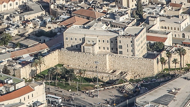
עברית: העיר העתיקה בירושלים (בערבית: بلدة القدس القديمة, נהגה: בִּלִדַת אֶלקוּדְס אֶלקָדִימָה) היא האזור העירוני העתיק של ירושלים. שטחה המוקף על ידי חומות ירושלים הוא כ-850 דונם.כמו כן נכללים בעיר העתיקה הר ציון ועיר דוד, הנמצאים מחוץ לחומות, בסמוך ומצד דרום. העיר העתיקה מהווה מוקד משיכה מרכזי לתיירים בני דתות ואומות שונות, אשר באים מרחבי העולם לבקר את האתרים הקדושים הנמצאים בה, ובהם: הר הבית, הכותל המערבי וכנסיית הקבר.
|
||
| Date | |||
| Source | Own work | ||
| Author | תומר פלד | ||
| Other versions |

.jpg&action=edit§ion=1)
| Camera location | | View this and other nearby images on: OpenStreetMap |
|---|
.jpg¶ms=031.463600_N_0035.143000_E_globe:Earth_type:camera__&language=en)
Licensing[edit]
.jpg&action=edit§ion=2)
I, the copyright holder of this work, hereby publish it under the following license:
This file is licensed under the Creative Commons Attribution-Share Alike 3.0 Unported license.
- You are free:
- to share – to copy, distribute and transmit the work
- to remix – to adapt the work
- Under the following conditions:
- attribution – You must give appropriate credit, provide a link to the license, and indicate if changes were made. You may do so in any reasonable manner, but not in any way that suggests the licensor endorses you or your use.
- share alike – If you remix, transform, or build upon the material, you must distribute your contributions under the same or compatible license as the original.

|
This image was uploaded as part of Wiki Loves Monuments 2014.
|
 |
File history
Click on a date/time to view the file as it appeared at that time.
| Date/Time | Thumbnail | Dimensions | User | Comment | |
|---|---|---|---|---|---|
| current | 00:17, 16 June 2021 | | 1,361 × 772 (972 KB) | Onceinawhile (talk | contribs) | File:מבט אווירי על העיר העתיקה בירושלים.jpg cropped 76 % horizontally, 80 % vertically using CropTool with precise mode. |
You cannot overwrite this file.
File usage on Commons
The following page uses this file:
File usage on other wikis
The following other wikis use this file:
- Usage on en.wikipedia.org
.jpg&oldid=737038263)