File:Quetta map before 1935.jpg
Jump to navigation
Jump to search
Size of this preview: 800 × 586 pixels. Other resolutions: 320 × 234 pixels | 640 × 469 pixels | 1,024 × 750 pixels | 1,159 × 849 pixels.
Original file (1,159 × 849 pixels, file size: 950 KB, MIME type: image/jpeg)
Captions
Captions
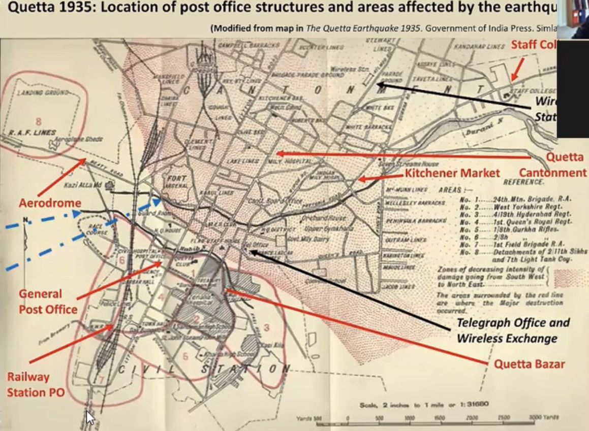
Map of Quetta in 1930s
Summary
[edit]
| Description |
English: Map of Quetta before the earthquake of 1935. |
| Date | before 1935 |
| Source | Scan from the original work |
| Author | Unknown |
Licensing
[edit]
This Pakistani work is now in the public domain because its term of copyright has expired according to the Copyright Ordinance, 1962 as amended by Copyright (Amendment) Ordinance, 2000 (details). The work meets one of the following criteria:
To the uploader: Please provide all relevant authorship and publication details. |
 |
This work is in the public domain in the United States because it meets three requirements:
For background information, see the explanations on Non-U.S. copyrights.
Note: This tag should not be used for sound recordings. |
File history
Click on a date/time to view the file as it appeared at that time.
| Date/Time | Thumbnail | Dimensions | User | Comment | |
|---|---|---|---|---|---|
| current | 09:06, 8 November 2022 | | 1,159 × 849 (950 KB) | Talib1234 (talk | contribs) | Uploaded own work with UploadWizard |
You cannot overwrite this file.
File usage on Commons
There are no pages that use this file.
File usage on other wikis
The following other wikis use this file:
- Usage on en.wikipedia.org