File:Röslau Eger catchment.png
Jump to navigation
Jump to search

Size of this preview: 707 × 599 pixels. Other resolutions: 283 × 240 pixels | 566 × 480 pixels | 906 × 768 pixels | 1,208 × 1,024 pixels | 1,683 × 1,427 pixels.
Original file (1,683 × 1,427 pixels, file size: 1.61 MB, MIME type: image/png)
Captions
Captions
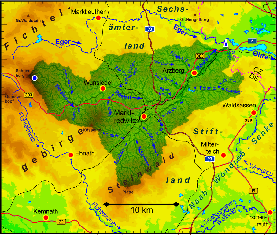
Catchment area of the Röslau river
Summary[edit]
| Description |
Deutsch: Einzugsgebiet der Röslau (Nebenfluss der Eger/Ohře), hervorgehoben dargestellt, und Topografie (räumliche Auflösung 35 m, Höhenstufen 50 m).
English: Catchment area of the Röslau river (tributary of the Eger/Ohře river) emphasized, and the terrain elevation (spatial resolution 35 m and elevation steps of 50 m). |
| Date | |
| Source | Own work |
| Author | Periphrastika |
Own work based on ASTER Digital Elevation Model data by https://lpdaac.usgs.gov/ and own runoff calculation. Geographical data provided by OpenStreetMap and contributors.
Licensing[edit]
I, the copyright holder of this work, hereby publish it under the following license:
This file is licensed under the Creative Commons Attribution-Share Alike 4.0 International license.
- You are free:
- to share – to copy, distribute and transmit the work
- to remix – to adapt the work
- Under the following conditions:
- attribution – You must give appropriate credit, provide a link to the license, and indicate if changes were made. You may do so in any reasonable manner, but not in any way that suggests the licensor endorses you or your use.
- share alike – If you remix, transform, or build upon the material, you must distribute your contributions under the same or compatible license as the original.
File history
Click on a date/time to view the file as it appeared at that time.
| Date/Time | Thumbnail | Dimensions | User | Comment | |
|---|---|---|---|---|---|
| current | 16:08, 1 December 2021 | | 1,683 × 1,427 (1.61 MB) | Periphrastika (talk | contribs) | Uploaded own work with UploadWizard |
You cannot overwrite this file.
File usage on Commons
There are no pages that use this file.
File usage on other wikis
The following other wikis use this file:
- Usage on de.wikipedia.org