File:Ręczno (gmina) location map.png

Original file (1,368 × 2,892 pixels, file size: 451 KB, MIME type: image/png)
Captions
Captions
Summary
[edit]_location_map.png&action=edit§ion=1)
| Description |
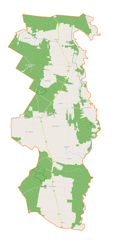
English: Location map |
| Date | |
| Source | Own work |
| Author | Smat |
| Description |
Polski: Mapa gminy Ręczno, Polska
English: Map of Ręczno (gmina), Poland |
|||||||||
| Date | ||||||||||
| Source | You may find a page on the OpenStreetMap wiki page for Ręczno (gmina) | |||||||||
| Creator |
OpenStreetMap contributors OpenStreetMap contributors |
|||||||||
| Permission (Reusing this file) |
OpenStreetMap data is available under the Open Database License (details). Map tiles are licensed under the Creative Commons Attribution-ShareAlike 2.0 license (CC-BY-SA 2.0).
This file is licensed under the Creative Commons Attribution-Share Alike 2.0 Generic license.
|
|||||||||
| Geotemporal data | ||||||||||
| Bounding box |
|
|||||||||
| Georeferencing | If inappropriate please set warp_status = skip to hide. | |||||||||
Licensing
[edit]_location_map.png&action=edit§ion=2)
| This work contains information from OpenStreetMap, which is made available under the Open Database License (ODbL).
The ODbL does not require any particular license for maps produced from ODbL data. Prior to 1 August 2020, map tiles produced by the OpenStreetMap Foundation were licensed under the CC-BY-SA-2.0 license. Maps produced by other people may be subject to other licences. |
File history
Click on a date/time to view the file as it appeared at that time.
| Date/Time | Thumbnail | Dimensions | User | Comment | |
|---|---|---|---|---|---|
| current | 16:37, 5 December 2017 | | 1,368 × 2,892 (451 KB) | Smat (talk | contribs) | User created page with UploadWizard |
You cannot overwrite this file.
File usage on Commons
There are no pages that use this file.
File usage on other wikis
The following other wikis use this file:
- Usage on pl.wikipedia.org
- Łęg Ręczyński
- Ręczno (wieś)
- Bąkowa Góra
- Będzyn (powiat piotrkowski)
- Łęki Królewskie
- Paskrzyn (wieś w województwie łódzkim)
- Kolonia Ręczno
- Stobnica-Piła
- Majkowice (województwo łódzkie)
- Nowinki (województwo łódzkie)
- Stobnica (województwo łódzkie)
- Wielkopole (województwo łódzkie)
- Dęba (powiat piotrkowski)
- Zbyłowice
- Zamek w Majkowicach
- Rezerwat przyrody Jawora
- Rezerwat przyrody Wielkopole
- Parafia św. Stanisława BM w Ręcznie
- Dęba-Majstry
- Młynek Poduchowny
- Paskrzyn (kolonia w województwie łódzkim)
- Placówka (województwo łódzkie)
- Przewóz (województwo łódzkie)
- Ręczno (osada leśna)
- Wyrębel
- Parafia Trójcy Przenajświętszej w Bąkowej Górze
- Moduł:Mapa/dane/Ręczno (gmina)
- Zamek w Bąkowej Górze
- Kościół Najświętszej Maryi Panny Pocieszenia i św. Stanisława w Ręcznie
- Wikipedysta:Terminuspl/Zamek Surdęga
- Zamek Surdęga
- Ignaców Poduchowny
- Czartoryja (Ręczno)
- Usage on pl.wikibooks.org
_location_map.png&oldid=607600941)