File:RER ligne A Paris plan2035.svg.2019 12 18 01 46 27.0.svg
Jump to navigation
Jump to search

Size of this PNG preview of this SVG file: 800 × 310 pixels. Other resolutions: 320 × 124 pixels | 640 × 248 pixels | 1,024 × 397 pixels | 1,280 × 496 pixels | 2,560 × 992 pixels | 2,801 × 1,085 pixels.
Original file (SVG file, nominally 2,801 × 1,085 pixels, file size: 269 KB)
Captions
Captions
Add a one-line explanation of what this file represents
Summary
[edit]
| Description |
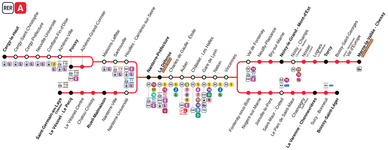
Français : Plan de la ligne |
| Date | |
| Source | Own work |
| Author | AlexBurn44 |
Licensing
[edit]
I, the copyright holder of this work, hereby publish it under the following license:
This file is licensed under the Creative Commons Attribution-Share Alike 4.0 International license.
- You are free:
- to share – to copy, distribute and transmit the work
- to remix – to adapt the work
- Under the following conditions:
- attribution – You must give appropriate credit, provide a link to the license, and indicate if changes were made. You may do so in any reasonable manner, but not in any way that suggests the licensor endorses you or your use.
- share alike – If you remix, transform, or build upon the material, you must distribute your contributions under the same or compatible license as the original.
File history
Click on a date/time to view the file as it appeared at that time.
| Date/Time | Thumbnail | Dimensions | User | Comment | |
|---|---|---|---|---|---|
| current | 16:07, 31 May 2022 | 2,801 × 1,085 (269 KB) | AlexBurn44 (talk | contribs) | - | |
| 22:15, 30 May 2022 | 2,801 × 1,085 (269 KB) | AlexBurn44 (talk | contribs) | Format + Logos | ||
| 14:16, 30 December 2019 | 2,976 × 1,147 (381 KB) | AlexBurn44 (talk | contribs) | ++ | ||
| 14:12, 30 December 2019 | 2,976 × 1,147 (381 KB) | AlexBurn44 (talk | contribs) | User created page with UploadWizard |
You cannot overwrite this file.
File usage on Commons
The following 5 pages use this file:
- User:Chumwa/OgreBot/Potential transport maps/2019 December 21-31
- User:Chumwa/OgreBot/Public transport information/2019 December 21-31
- User:Chumwa/OgreBot/Public transport information/2022 May 21-31
- User:Chumwa/OgreBot/Transport Maps/2019 December 21-31
- User:Chumwa/OgreBot/Transport Maps/2022 May 21-31