File:RU RYA Skopinsky outline.svg

Original file (SVG file, nominally 888 × 493 pixels, file size: 537 KB)
Captions
Captions
Summary
[edit]
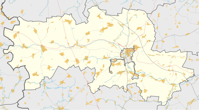
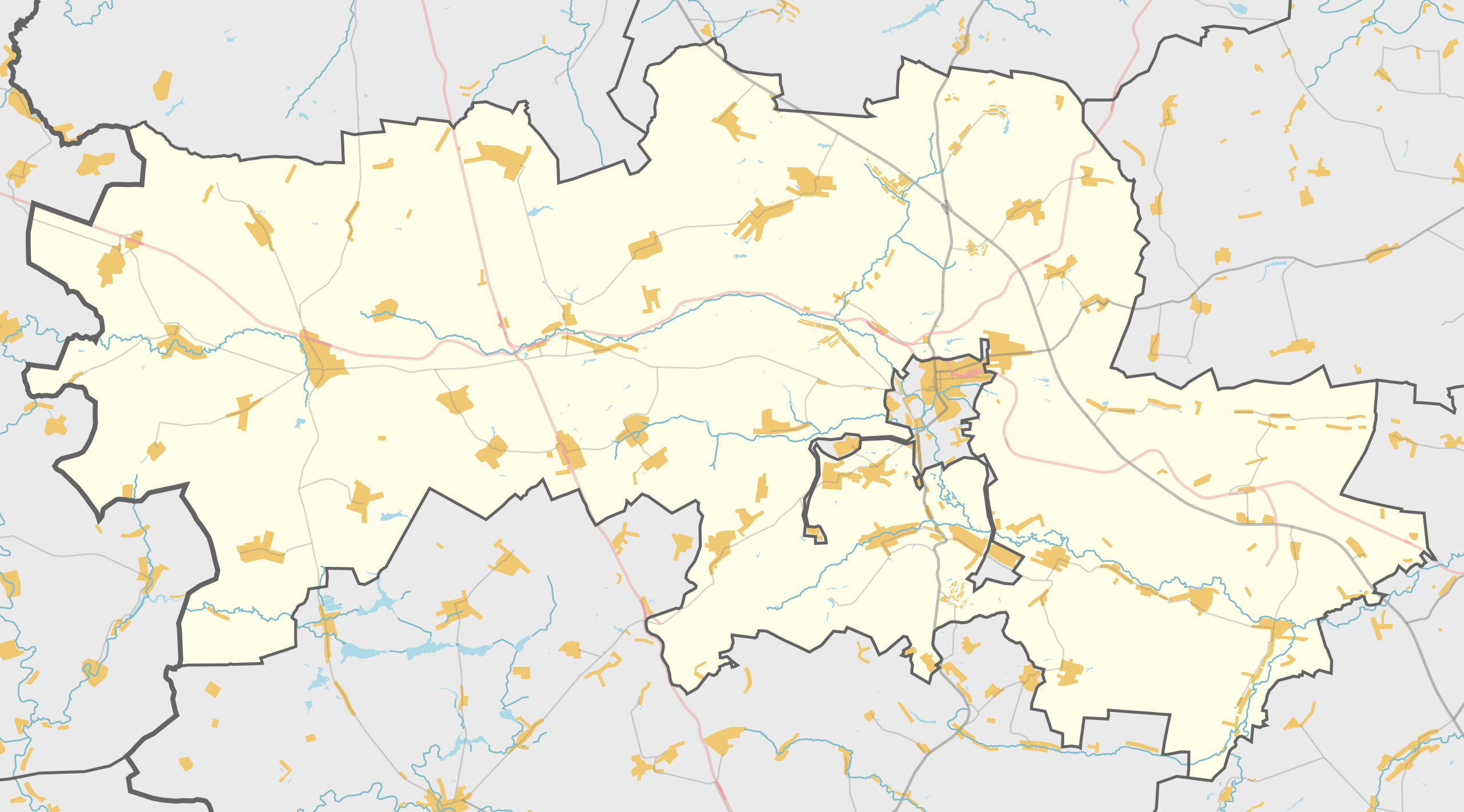
| Description |
Русский: Карта, Скопинский район Рязанской области. |
| Date | |
| Source | Own work using Maperitive tool on OpenStreetMap data, then Inkscape |
| Author | OpenStreetMap contributors & Nzeemin |
Licensing
[edit]
| Description |
This map was created from OpenStreetMap project data, collected by the community. This map may be incomplete, and may contain errors. Don't rely solely on it for navigation. |
|||
| Date | (see file history) | |||
| Source | openstreetmap.org | |||
| Creator |
OpenStreetMap contributors |
|||
| Permission (Reusing this file) |
OpenStreetMap data is available under the Open Database License (details). Map tiles are licensed under the Creative Commons Attribution-ShareAlike 2.0 license (CC-BY-SA 2.0).
This file is licensed under the Creative Commons Attribution-Share Alike 2.0 Generic license.
|
|||
| Georeferencing | If inappropriate please set warp_status = skip to hide. |
Details
[edit]
Maperitive commands:
set-geo-bounds 38.77,53.61,39.99,54.01
set-print-bounds-geo
zoom 10
export-svg compatibility=inkscape
File history
Click on a date/time to view the file as it appeared at that time.
| Date/Time | Thumbnail | Dimensions | User | Comment | |
|---|---|---|---|---|---|
| current | 16:48, 9 March 2014 | | 888 × 493 (537 KB) | Nzeemin (talk | contribs) | User created page with UploadWizard |
You cannot overwrite this file.
File usage on Commons
There are no pages that use this file.
File usage on other wikis
The following other wikis use this file:
- Usage on ru.wikipedia.org
- Павелец (рабочий посёлок)
- Поплевинский
- Побединка
- Катино (село, Скопинский район)
- Богослово (Рязанская область)
- Клекотки
- Свистовка (Скопинский район)
- Вослебово
- Шелемишево
- Желтухинский (Рязанская область)
- Шаблон:ПозКарта Россия Рязанская область Скопинский район
- Административно-территориальное деление Скопинского района
- Участник:Nzeemin/Карты/Районы
- Корневое
- Горлово (Рязанская область)
- Новобараково
- Хворощевка
- Нагиши (Рязанская область)
- Казинка (Рязанская область)
- Ильинка (Рязанская область)
- Петрушино (Корневское сельское поселение)
- Петрушино (Горловское сельское поселение)
- Дымово-Государственное
- Городецкое (Скопинский район)
- Нюховец
- Березняги (Рязанская область)
- Гремячка (Скопинский район)
- Николо-Скопин
- Вердерево
- Немерово (Рязанская область)
- Моховое (Рязанская область)
- Рождествено (Рязанская область)
- Боровое (Скопинский район)
- Костемерево
- Новое (Скопинский район)
- Поляны (Скопинский район)
- Дмитриево (Полянское сельское поселение)
- Ермолово (Скопинский район)
- Рудинка (Горловское сельское поселение)
- Дмитриево (Горловское сельское поселение)
- Затворное
- Муравлянка (Скопинский район)
- Делехово
- Князево (Скопинский район)
- Пупки (Рязанская область)
- Новые Кельцы
- Чулково (Скопинский район)
- Победное (Рязанская область)
- Секирино (Рязанская область)
- Лопатино (Рязанская область)
View more global usage of this file.