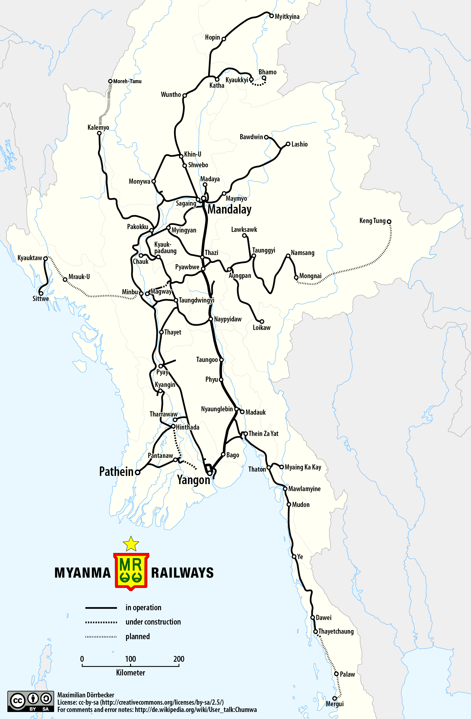
File:Railway map of Myanmar.png
跳至導覽
跳至搜尋
預覽大小:393 × 600 像素。 其他解析度:157 × 240 像素 | 314 × 480 像素 | 503 × 768 像素 | 671 × 1,024 像素 | 1,547 × 2,360 像素。
原始檔案 (1,547 × 2,360 像素,檔案大小:589 KB,MIME 類型:image/png)
說明
說明
添加單行說明來描述出檔案所代表的內容
| 描述 |
|
||
| 日期 | see file history | ||
| 來源 |
個人作品,使用: |
||
| 作者 | Maximilian Dörrbecker (Chumwa) | ||
| 授權許可 (重用此檔案) |
我,本作品的著作權持有者,決定用以下授權條款發佈本作品: 此檔案採用創用CC 姓名標示-相同方式分享 2.5 通用版授權條款。
Sie dürfen das Bild zu den folgenden Bedingungen nutzen:
|

檔案歷史
點選日期/時間以檢視該時間的檔案版本。
| 日期/時間 | 縮圖 | 尺寸 | 用戶 | 備註 | |
|---|---|---|---|---|---|
| 目前 | 2018年3月13日 (二) 01:53 | | 1,547 × 2,360(589 KB) | RaviC(對話 | 貢獻) | + Kale - Moreh/Tamu under construction railway |
| 2017年5月25日 (四) 05:51 |  | 1,547 × 2,360(525 KB) | Chumwa(對話 | 貢獻) | {{Information |Description= *{{de|Eisenbahnkarte von Myanmar}} *{{en|Railway map of Myanmar}} |Source={{Own using}} *borders of Myanmar by {{U|Uwe Dedering}} *[http://www.myanmarailways1877.com/sites/default/files/Pla... |
無法覆蓋此檔案。
檔案用途
下列11個頁面有用到此檔案:
- User:Chumwa/Gallery
- User:Chumwa/OgreBot/Potential transport maps/2017 May 21-31
- User:Chumwa/OgreBot/Potential transport maps/2018 March 11-20
- User:Chumwa/OgreBot/Public transport information/2017 May 21-31
- User:Chumwa/OgreBot/Public transport information/2018 March 11-20
- User:Chumwa/OgreBot/Transport Maps/2017 May 21-31
- User:Chumwa/OgreBot/Transport Maps/2018 March 11-20
- User:Chumwa/OgreBot/Travel and communication maps/2017 May 21-31
- User:Chumwa/OgreBot/Travel and communication maps/2018 March 11-20
- User:Chumwa/Railway maps
- Category:Rail transport in Myanmar
全域檔案使用狀況
以下其他 wiki 使用了這個檔案:
- de.wikipedia.org 的使用狀況
- en.wikipedia.org 的使用狀況
- ja.wikipedia.org 的使用狀況
- no.wikipedia.org 的使用狀況
- th.wikipedia.org 的使用狀況
- www.wikidata.org 的使用狀況
- zh.wikipedia.org 的使用狀況