File:Rajgród (gmina) location map.png
Jump to navigation
Jump to search

Size of this preview: 800 × 586 pixels. Other resolutions: 320 × 235 pixels | 640 × 469 pixels | 1,024 × 751 pixels | 1,285 × 942 pixels.
Original file (1,285 × 942 pixels, file size: 275 KB, MIME type: image/png)
Captions
Captions
Add a one-line explanation of what this file represents
| Description |
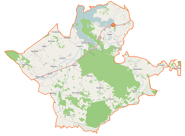
Polski: Mapa gminy Rajgród, Polska
English: Map of Gmina Rajgród, Poland |
|||||||||
| Date | ||||||||||
| Source | You may find a page on the OpenStreetMap wiki page for Rajgród (gmina) | |||||||||
| Creator |
OpenStreetMap contributors OpenStreetMap contributors |
|||||||||
| Permission (Reusing this file) |
OpenStreetMap data is available under the Open Database License (details). Map tiles are licensed under the Creative Commons Attribution-ShareAlike 2.0 license (CC-BY-SA 2.0).
This file is licensed under the Creative Commons Attribution-Share Alike 2.0 Generic license.
|
|||||||||
| Geotemporal data | ||||||||||
| Bounding box |
|
|||||||||
| Georeferencing | If inappropriate please set warp_status = skip to hide. | |||||||||
File history
Click on a date/time to view the file as it appeared at that time.
| Date/Time | Thumbnail | Dimensions | User | Comment | |
|---|---|---|---|---|---|
| current | 09:39, 16 September 2014 | | 1,285 × 942 (275 KB) | VanWiel (talk | contribs) | {{Information |Description= |Source= |Date= |Author= |Permission= |other_versions= }} |
| 06:14, 10 June 2014 |  | 1,285 × 942 (279 KB) | VanWiel (talk | contribs) | {{OpenStreetMap | name = Rajgród (gmina wiejska) | location = Rajgród (gmina wiejska) | description = {{pl|Mapa gminy Rajgród, Polska}} {{en|Map of Gmina Rajgród, Poland}} | top = 53.7629 | left... |
You cannot overwrite this file.
File usage on Commons
There are no pages that use this file.
File usage on other wikis
The following other wikis use this file:
- Usage on de.wikipedia.org
- Usage on pl.wikipedia.org
- Jezioro Rajgrodzkie
- Rajgród
- Rajgród (gmina)
- Rezerwat przyrody Czapliniec Bełda
- Kosiły
- Bełda
- Biebrza (województwo podlaskie)
- Ciszewo (województwo podlaskie)
- Łazarze
- Miecze
- Pieńczykowo
- Pieńczykówek
- Rybczyzna
- Skrodzkie
- Turczyn (powiat grajewski)
- Wojdy
- Woźnawieś
- Wólka Piotrowska
- Bukowo (województwo podlaskie)
- Czarna Wieś (województwo podlaskie)
- Karczewo (województwo podlaskie)
- Kołaki (województwo podlaskie)
- Kosówka (województwo podlaskie)
- Kozłówka (województwo podlaskie)
- Kuligi (województwo podlaskie)
- Orzechówka (województwo podlaskie)
- Sołki (województwo podlaskie)
- Przestrzele (powiat grajewski)
- Rydzewo (powiat grajewski)
- Stoczek (powiat grajewski)
- Wólka Mała (powiat grajewski)
- Danowo (gmina Rajgród)
- Karwowo (gmina Rajgród)
- Tama (województwo podlaskie)
- Budy (Rybczyzna)
- Pikły
- Przejma (województwo podlaskie)
- Cmentarz żydowski w Rajgrodzie
- Parafia Narodzenia Najświętszej Maryi Panny w Rajgrodzie
- Kościół Narodzenia Najświętszej Maryi Panny w Rajgrodzie
- Cmentarz wojenny w Bełdzie
- Cmentarz wojenny w Kosiłach
- Dworek Opartowo
- Moduł:Mapa/dane/Rajgród
- Moduł:Mapa/dane/Rajgród (gmina)
- Tworki (Skrodzkie)
- Parafia św. Wojciecha w Rydzewie
- Sacin (wyspa)
- Usage on pl.wikibooks.org
View more global usage of this file.
_location_map.png)
_location_map.png&oldid=519995091)