File:Regenbogenbrücke Dortmund über der A40.jpg
From Wikimedia Commons, the free media repository
Jump to navigation
Jump to search
![File:Regenbogenbrücke Dortmund über der A40.jpg](https://upload.wikimedia.org/wikipedia/commons/thumb/e/e7/Regenbogenbr%C3%BCcke_Dortmund_%C3%BCber_der_A40.jpg/800px-Regenbogenbr%C3%BCcke_Dortmund_%C3%BCber_der_A40.jpg?20131130204625)
Size of this preview: 800 × 534 pixels. Other resolutions: 320 × 213 pixels | 640 × 427 pixels | 1,024 × 683 pixels.
Original file (1,024 × 683 pixels, file size: 631 KB, MIME type: image/jpeg)
File information
Structured data
Captions
Captions
Add a one-line explanation of what this file represents
DescriptionRegenbogenbrücke Dortmund über der A40.jpg |
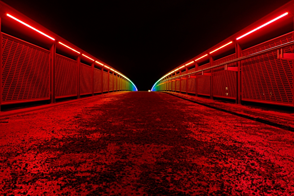
Deutsch: Die Regenbogenbrücke in Dortmund, die den Campus-Nord mit dem südlichen Dorstfeld verbindet, macht nachts ihrem Namen alle Ehre und leuchtet in allen Farben des Regenbogens. |
||
Date | |||
Source | Flickr: Regenbogenbrücke über der B1/A40 | ||
Author | Daniel Hess | ||
Permission (Reusing this file) |
![]() ![]() ![]() This file is licensed under the Creative Commons Attribution-Share Alike 2.0 Generic license.
|
Camera location | 51° 29′ 48.58″ N, 7° 25′ 11.01″ E ![]() | View this and other nearby images on: OpenStreetMap | ![]() |
---|
File history
Click on a date/time to view the file as it appeared at that time.
Date/Time | Thumbnail | Dimensions | User | Comment | |
---|---|---|---|---|---|
current | 20:46, 30 November 2013 | ![]() | 1,024 × 683 (631 KB) | Flickr upload bot (talk | contribs) | Uploaded from http://flickr.com/photo/43997818@N08/5365478192 using Flickr upload bot |
You cannot overwrite this file.
File usage on Commons
There are no pages that use this file.
Metadata
This file contains additional information such as Exif metadata which may have been added by the digital camera, scanner, or software program used to create or digitize it. If the file has been modified from its original state, some details such as the timestamp may not fully reflect those of the original file. The timestamp is only as accurate as the clock in the camera, and it may be completely wrong.
Camera manufacturer | Panasonic |
---|---|
Camera model | DMC-LX3 |
Author | Daniel Hess <daniel(at)rio-grande.ping.de> |
Exposure time | 1/1 sec (1) |
F-number | f/2.8 |
ISO speed rating | 80 |
Date and time of data generation | 19:06, 14 January 2011 |
Lens focal length | 5.1 mm |
Latitude | 51° 29′ 48.58″ N |
Longitude | 7° 25′ 11.01″ E |
Altitude | 113 meters above sea level |
Width | 1,024 px |
Height | 683 px |
Orientation | Normal |
Horizontal resolution | 72 dpi |
Vertical resolution | 72 dpi |
Software used | GIMP 2.6.11 |
File change date and time | 00:20, 18 January 2011 |
Y and C positioning | Co-sited |
Exposure Program | Manual |
Exif version | 2.21 |
Date and time of digitizing | 19:06, 14 January 2011 |
Meaning of each component |
|
Image compression mode | 4 |
APEX exposure bias | 0 |
Maximum land aperture | 2 APEX (f/2) |
Metering mode | Pattern |
Light source | Unknown |
Flash | Flash did not fire, compulsory flash suppression |
Supported Flashpix version | 1 |
Color space | sRGB |
Sensing method | One-chip color area sensor |
File source | Digital still camera |
Scene type | A directly photographed image |
Custom image processing | Normal process |
Exposure mode | Manual exposure |
White balance | Auto white balance |
Digital zoom ratio | 0 |
Focal length in 35 mm film | 24 mm |
Scene capture type | Standard |
Scene control | None |
Contrast | Normal |
Saturation | Normal |
Sharpness | Normal |
Geodetic survey data used | WGS-84 |
GPS tag version | 0.0.0.2 |
Image width | 1,024 px |
Image height | 683 px |