File:Relief Map of Shida Kartli.svg
Aller à la navigation
Aller à la recherche

Taille de cet aperçu PNG pour ce fichier SVG : 640 × 600 pixels. Autres résolutions : 256 × 240 pixels | 819 × 768 pixels | 1 092 × 1 024 pixels | 2 185 × 2 048 pixels | 783 × 734 pixels.
Fichier d’origine (Fichier SVG, nominalement de 783 × 734 pixels, taille : 8,21 Mio)
Légendes
Légendes
Ajoutez en une ligne la description de ce que représente ce fichier
Description
[modifier]| Description |
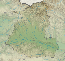
English: Relief map of Shida Kartli
Mercator projection. Geographic limits of the map:
|
||
| Date | |||
| Source | Travail personnel de la personne qui a téléchargé à l'origine le document. | ||
| Auteur | Giorgi Balakhadze sur Wikipédia anglais |


Conditions d’utilisation
[modifier]
Giorgi Balakhadze sur Wikipédia anglais, en tant que détenteur des droits d’auteur sur cette œuvre, la publie sous la licence suivante :
Ce fichier est disponible selon les termes de la licence Creative Commons Attribution 4.0 International.
Attribution: Giorgi Balakhadze sur Wikipédia anglais
- Vous êtes libre :
- de partager – de copier, distribuer et transmettre cette œuvre
- d’adapter – de modifier cette œuvre
- Sous les conditions suivantes :
- paternité – Vous devez donner les informations appropriées concernant l'auteur, fournir un lien vers la licence et indiquer si des modifications ont été faites. Vous pouvez faire cela par tout moyen raisonnable, mais en aucune façon suggérant que l’auteur vous soutient ou approuve l’utilisation que vous en faites.
Journal des téléversements d’origine
[modifier]
La page de description originale était ici. Tous les noms d'utilisateur qui suivent se rapportent à en.wikipedia.
| Date et heure | Dimensions | Utilisateur | Commentaire |
|---|---|---|---|
| 2016-06-17 13:29 | 783×734× (8608739 bytes) | Giorgi Balakhadze | fix |
| 2016-06-17 12:40 | 783×734× (8613485 bytes) | Giorgi Balakhadze | {{Copy to Commons|human=Giorgi Balakhadze}} == Summary == {{Information |Description={{en|Relief map of [[:en:Georgia (country)|Georgia]]}} </br>Mercator projection. Geographic limits of the map: * N: 42.65° N * S: 41.68° N * W: 43.31.8° E * E: 44.6... |
Historique du fichier
Cliquer sur une date et heure pour voir le fichier tel qu'il était à ce moment-là.
| Date et heure | Vignette | Dimensions | Utilisateur | Commentaire | |
|---|---|---|---|---|---|
| actuel | 15 janvier 2019 à 22:30 | | 783 × 734 (8,21 Mio) | Giorgi Balakhadze (d | contributions) | style fix |
| 19 juin 2016 à 01:32 |  | 783 × 734 (8,21 Mio) | OgreBot (d | contributions) | (BOT): Reverting to most recent version before archival | |
| 19 juin 2016 à 01:32 |  | 783 × 734 (8,21 Mio) | OgreBot (d | contributions) | (BOT): Uploading old version of file from en.wikipedia; originally uploaded on 2016-06-17 12:40:11 by Giorgi Balakhadze | |
| 18 juin 2016 à 09:31 |  | 783 × 734 (8,21 Mio) | কায়সার আহমাদ (d | contributions) | Transferred from en.wikipedia |
Vous ne pouvez pas remplacer ce fichier.
Utilisations locales du fichier
Les 32 pages suivantes utilisent ce fichier :
- User:Giorgi Balakhadze/Lab
- User:Jaqeli/Georgia
- File:Georgia Abkhazia relief location map.svg
- File:Georgia Adjara location map.svg
- File:Georgia Adjara location relief map.svg
- File:Georgia Autonomous Republic of Abkhazia Location map.svg
- File:Georgia Guria location map.svg
- File:Georgia Guria relief location map.svg
- File:Georgia Imereti location map.svg
- File:Georgia Imereti relief location map.svg
- File:Georgia Kakheti location map.svg
- File:Georgia Kakheti relief location map.svg
- File:Georgia Kvemo Kartli location map.svg
- File:Georgia Kvemo Kartli relief location map.svg
- File:Georgia Mtskheta-Mtianeti location map.svg
- File:Georgia Mtskheta-Mtianeti relief location map.svg
- File:Georgia Racha-Lechkhumi and Kvemo Svaneti location map.svg
- File:Georgia Racha-Lechkhumi and Kvemo Svaneti relief location map.svg
- File:Georgia Samegrelo-Zemo Svaneti location map.svg
- File:Georgia Samegrelo-Zemo Svaneti relief location map.svg
- File:Georgia Samtskhe-Javakheti location map.svg
- File:Georgia Shida Kartli location map.svg
- File:Georgia Tbilisi location map.svg
- File:Georgia Tbilisi relief location map.svg
- File:Georgia location map2.svg
- File:Relief Map of Georgia.svg
- File:Relief Map of Samtskhe-Javakheti.svg
- File:Relief Map of Shida Kartli.svg
- Template:Georgia's location maps
- Category:Maps of Shida Kartli
- Category:Populated places in Shida Kartli
- Category:Shida Kartli
Utilisations du fichier sur d’autres wikis
Les autres wikis suivants utilisent ce fichier :
- Utilisation sur ar.wikipedia.org
- Utilisation sur az.wikipedia.org
- Utilisation sur de.wikipedia.org
- Utilisation sur en.wikipedia.org
- Gori, Georgia
- Java, South Ossetia
- Shida Kartli
- Tskhinvali
- Likhi Range
- Khashuri
- Kaspi
- Kldekari (mountain)
- Kabargin Oth Group
- Surami
- Kareli, Georgia
- Britat
- Bateti Lake
- Keli Highland
- Module:Location map/data/Shida Kartli
- Module:Location map/data/Shida Kartli/doc
- Geri, Georgia
- Liakhvi Strict Nature Reserve
- Nabakhtevi Virgin Mary Church
- Khtsisi John the Baptist church
- Ateni gorge
- Samtsevrisi Castle
- Tsona Cave
- Utilisation sur eo.wikipedia.org
- Utilisation sur es.wikipedia.org
- Utilisation sur fa.wikipedia.org
- Utilisation sur fr.wikipedia.org
- Utilisation sur he.wikipedia.org
- Utilisation sur mdf.wikipedia.org
- Utilisation sur nl.wikipedia.org
Voir davantage sur l’utilisation globale de ce fichier.