File:Relief Map of Vologda Oblast.png
Jump to navigation
Jump to search

Size of this preview: 800 × 457 pixels. Other resolutions: 320 × 183 pixels | 640 × 365 pixels | 1,000 × 571 pixels.
Original file (1,000 × 571 pixels, file size: 972 KB, MIME type: image/png)
Captions
Captions
Add a one-line explanation of what this file represents
Summary
[edit]| Description |
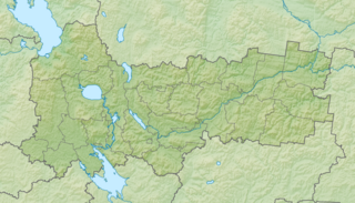
Русский: Физическая карта Вологодской области Равноугольная проекция. Координаты краёв:
|
| Date | |
| Source | |
| Author | Виктор В |
| Other versions |
|

Licensing
[edit]
| I, the copyright holder of this work, release this work into the public domain. This applies worldwide. In some countries this may not be legally possible; if so: I grant anyone the right to use this work for any purpose, without any conditions, unless such conditions are required by law. |
File history
Click on a date/time to view the file as it appeared at that time.
| Date/Time | Thumbnail | Dimensions | User | Comment | |
|---|---|---|---|---|---|
| current | 18:50, 2 August 2010 | | 1,000 × 571 (972 KB) | Виктор В (talk | contribs) | == {{int:filedesc}} == {{Information |Description={{ru|1=Физическая карта Вологодской области<br\>Равноугольная проекция. Координаты краёв: * север — 62.0° С * юг — 58.0° � |
You cannot overwrite this file.
File usage on Commons
The following page uses this file:
File usage on other wikis
The following other wikis use this file:
- Usage on avk.wikipedia.org
- Usage on ba.wikipedia.org
- Usage on be.wikipedia.org
- Usage on bg.wikipedia.org
- Вологда
- Череповец
- Шаблон:ПК Русия Вологодска област
- Бабаево
- Витегра
- Белозерск
- Велики Устюг
- Грязовец
- Кадников
- Красавино
- Николск (Вологодска област)
- Сокол (град)
- Тотма
- Устюжна
- Харовск
- Вожега
- Вохтога
- Кадуй (селище от градски тип)
- Палтога
- Сухона
- Юг (река)
- Бяло езеро (Русия)
- Воже
- Кубенско езеро
- Андомско възвишение
- Вепсовско възвишение
- Кубена
- Кичменга
- Кулой (приток на Вага)
- Кокшенга
- Чагодоща
- Колп
- Usage on ce.wikipedia.org
- Usage on cs.wikipedia.org
- Usage on da.wikipedia.org
- Usage on de.wikipedia.org
View more global usage of this file.