File:Rheinruhr.png
Jump to navigation
Jump to search

Size of this preview: 580 × 599 pixels. Other resolutions: 232 × 240 pixels | 465 × 480 pixels | 703 × 726 pixels.
Original file (703 × 726 pixels, file size: 105 KB, MIME type: image/png)
Captions
Captions
Add a one-line explanation of what this file represents

|
This map image could be re-created using vector graphics as an SVG file. This has several advantages; see Commons:Media for cleanup for more information. If an SVG form of this image is available, please upload it and afterwards replace this template with
{{vector version available|new image name}}.
It is recommended to name the SVG file “Rheinruhr.svg”—then the template Vector version available (or Vva) does not need the new image name parameter. |
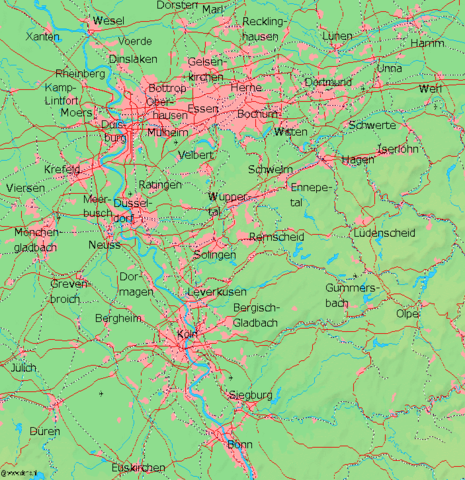
Karte des Rhein-Ruhrgebietes in Deutschland, Kartenquelle: [1][dead link]

|
Permission is granted to copy, distribute and/or modify this document under the terms of the GNU Free Documentation License, Version 1.2 or any later version published by the Free Software Foundation; with no Invariant Sections, no Front-Cover Texts, and no Back-Cover Texts. A copy of the license is included in the section entitled GNU Free Documentation License. |
| This file is licensed under the Creative Commons Attribution-Share Alike 3.0 Unported license. | ||
| ||
| This licensing tag was added to this file as part of the GFDL licensing update. |
File history
Click on a date/time to view the file as it appeared at that time.
| Date/Time | Thumbnail | Dimensions | User | Comment | |
|---|---|---|---|---|---|
| current | 18:25, 20 July 2013 | | 703 × 726 (105 KB) | Seiduselbst~commonswiki (talk | contribs) | the current file is faulty (see Dortmund) |
| 14:47, 21 December 2007 |  | 703 × 726 (90 KB) | Steinsky (talk | contribs) | Increased contrast between main shades for RG colour blind. | |
| 22:31, 9 January 2006 |  | 703 × 726 (104 KB) | Piedone (talk | contribs) | ||
| 22:43, 8 January 2006 |  | 703 × 726 (105 KB) | Piedone (talk | contribs) | ||
| 15:52, 8 January 2006 |  | 703 × 726 (104 KB) | Piedone (talk | contribs) | ||
| 09:46, 7 January 2006 |  | 703 × 726 (103 KB) | Piedone (talk | contribs) | Oberhausen added | |
| 13:22, 18 December 2004 |  | 703 × 726 (85 KB) | Markus Schweiss (talk | contribs) | Karte des Rhein-Ruhrgebietes in Deutschland, Kartenquelle: [http://www2.demis.nl/mapserver//mapper.asp] {{GFDL}} |
You cannot overwrite this file.
File usage on Commons
The following 2 pages use this file:
File usage on other wikis
The following other wikis use this file:
- Usage on de.wikipedia.org
- Usage on en.wikipedia.org
- Usage on et.wikipedia.org
- Usage on fi.wikipedia.org
- Usage on mk.wikipedia.org
- Usage on no.wikipedia.org
- Usage on ru.wikipedia.org
- Usage on sco.wikipedia.org
- Usage on sr.wikipedia.org
- Usage on sv.wikipedia.org
- Usage on tr.wikipedia.org