File:Riverslosangeles.jpg
Jump to navigation
Jump to search

Size of this preview: 617 × 600 pixels. Other resolutions: 247 × 240 pixels | 494 × 480 pixels | 790 × 768 pixels | 1,053 × 1,024 pixels | 1,739 × 1,691 pixels.
Original file (1,739 × 1,691 pixels, file size: 3.46 MB, MIME type: image/jpeg)
Captions
Captions
Add a one-line explanation of what this file represents
| Description |
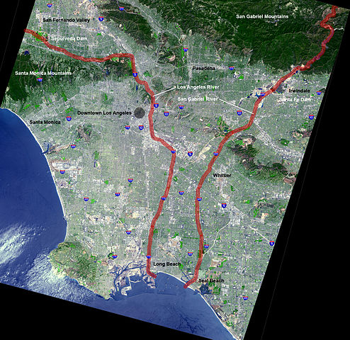
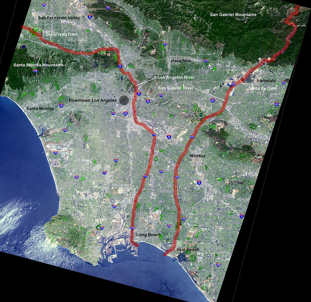
English: Map of the en:Los Angeles Basin with the Los Angeles River and San Gabriel River highlighted in red ladge |
| Date |
2 October 2005 (original upload date) |
| Source | NASA (original) |
| Author | en:User:Mikeetc The overlying work is by me |
| Other versions | Underlying map is an aerial map obtained from NASA (original) |
Licensing[edit]
| This file is in the public domain in the United States because it was solely created by NASA. NASA copyright policy states that "NASA material is not protected by copyright unless noted". (See Template:PD-USGov, NASA copyright policy page or JPL Image Use Policy.) | ||
 |
Warnings:
|
| This work has been released into the public domain by its author, Mikeetc at English Wikipedia. This applies worldwide. In some countries this may not be legally possible; if so: Mikeetc grants anyone the right to use this work for any purpose, without any conditions, unless such conditions are required by law. |
Original upload log[edit]
The original description page was here. All following user names refer to en.wikipedia.
- 2005-10-02 11:07 Mikeetc 1739×1691× (3632156 bytes) Map of the Los Angeles Basin with the Los Angeles and San Gabriel Rivers highlighted in red Underlying map is an aerial map obtained from NASA (original: http://earthobservatory.nasa.gov/Newsroom/NewImages/images.php3?img_id=5118 The overlying work is by
- 2005-10-02 05:28 Mikeetc 1739×1691× (3631971 bytes) Map of the Los Angeles Basin with the Los Angeles and San Gabriel Rivers highlighted in red Underlying map is an aerial map obtained from NASA (original: http://earthobservatory.nasa.gov/Newsroom/NewImages/images.php3?img_id=5118 The overlying work is b
File history
Click on a date/time to view the file as it appeared at that time.
| Date/Time | Thumbnail | Dimensions | User | Comment | |
|---|---|---|---|---|---|
| current | 17:23, 25 February 2009 | | 1,739 × 1,691 (3.46 MB) | Evrik (talk | contribs) | {{Information |Description={{en|Map of the en:Los Angeles Basin with the en:Los Angeles River and San Gabriel River highlighted in red ladge}} |Source=Transferred from [http://en.wikipedia.org en.wikipedia |
You cannot overwrite this file.
File usage on Commons
There are no pages that use this file.
File usage on other wikis
The following other wikis use this file:
- Usage on arz.wikipedia.org
- Usage on ca.wikipedia.org
- Usage on en.wikipedia.org
- Usage on fr.wikipedia.org
- Usage on he.wikipedia.org
- Usage on ja.wikipedia.org
- Usage on pt.wikipedia.org
- Usage on simple.wikipedia.org