File:Rogowo (gmina w powiecie rypińskim) location map.png
Jump to navigation
Jump to search
Size of this preview: 800 × 444 pixels. Other resolutions: 320 × 178 pixels | 640 × 355 pixels | 893 × 496 pixels.
Original file (893 × 496 pixels, file size: 84 KB, MIME type: image/png)
Captions
Captions
Add a one-line explanation of what this file represents
| Description |
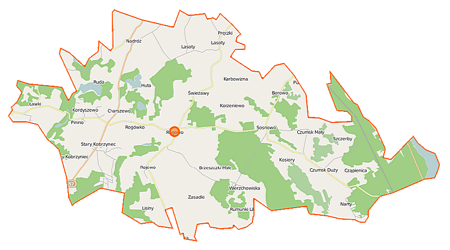
Polski: Mapa gminy Rogowo, Polska
English: Map of Gmina Rogowo, Poland |
|||||||||
| Date | ||||||||||
| Source | You may find a page on the OpenStreetMap wiki page for Rogowo (gmina w powiecie rypińskim) | |||||||||
| Creator |
OpenStreetMap contributors OpenStreetMap contributors |
|||||||||
| Permission (Reusing this file) |
OpenStreetMap data is available under the Open Database License (details). Map tiles are licensed under the Creative Commons Attribution-ShareAlike 2.0 license (CC-BY-SA 2.0).
This file is licensed under the Creative Commons Attribution-Share Alike 2.0 Generic license.
|
|||||||||
| Geotemporal data | ||||||||||
| Bounding box |
|
|||||||||
| Georeferencing | If inappropriate please set warp_status = skip to hide. | |||||||||
File history
Click on a date/time to view the file as it appeared at that time.
| Date/Time | Thumbnail | Dimensions | User | Comment | |
|---|---|---|---|---|---|
| current | 20:42, 8 November 2014 | | 893 × 496 (84 KB) | VanWiel (talk | contribs) | {{OpenStreetMap | name = Rogowo (gmina w powiecie rypińskim) | location = Rogowo (gmina w powiecie rypińskim) | description = {{pl|Mapa gminy Rogowo, Polska}} {{en|Map of Gmina Rogowo, Poland}} | top = 53... |
You cannot overwrite this file.
File usage on Commons
There are no pages that use this file.
File usage on other wikis
The following other wikis use this file:
- Usage on pl.wikipedia.org
- Rogowo (gmina w powiecie rypińskim)
- Brzeszczki Duże
- Brzeszczki Małe
- Charszewo
- Czumsk Duży
- Czumsk Mały
- Huta-Chojno
- Karbowizna
- Kosiory
- Lasoty
- Nowy Kobrzyniec
- Pinino (powiat rypiński)
- Pręczki
- Rumunki Likieckie
- Szczerby
- Stary Kobrzyniec
- Świeżawy
- Sosnowo (wieś w województwie kujawsko-pomorskim)
- Wierzchowiska (województwo kujawsko-pomorskie)
- Borowo (powiat rypiński)
- Huta (powiat rypiński)
- Lisiny (powiat rypiński)
- Narty (powiat rypiński)
- Rogowo (powiat rypiński)
- Rojewo (powiat rypiński)
- Rogówko (powiat rypiński)
- Ruda (gmina Rogowo)
- Nadróż
- Parafia św. Bartłomieja w Rogowie
- Kordyszewo
- Korzeniewo (województwo kujawsko-pomorskie)
- Zamość (powiat rypiński)
- Zasadki (powiat rypiński)
- Seperak
- Sosnowo (osada leśna w województwie kujawsko-pomorskim)
- Ławki (województwo kujawsko-pomorskie)
- Reszki (województwo kujawsko-pomorskie)
- Nadróż (kolonia)
- Urszulewo (gmina Rogowo)
- Tartak (województwo kujawsko-pomorskie)
- Jezioro Nadroskie
- Moduł:Mapa/dane/Rogowo (gmina w powiecie rypińskim)
- Kościół św. Bartłomieja w Rogowie
- Rumunki Nadroskie
- Usage on pl.wikibooks.org
_location_map.png&oldid=519995825)