File:Rohrleitungen Wasserkraftwerk VETS Aleko.jpg
Jump to navigation
Jump to search

Size of this preview: 800 × 533 pixels. Other resolutions: 320 × 213 pixels | 640 × 427 pixels | 1,024 × 683 pixels | 1,280 × 853 pixels | 3,000 × 2,000 pixels.
Original file (3,000 × 2,000 pixels, file size: 3.05 MB, MIME type: image/jpeg)
Captions
Captions
Add a one-line explanation of what this file represents
Summary
[edit]
| Description |
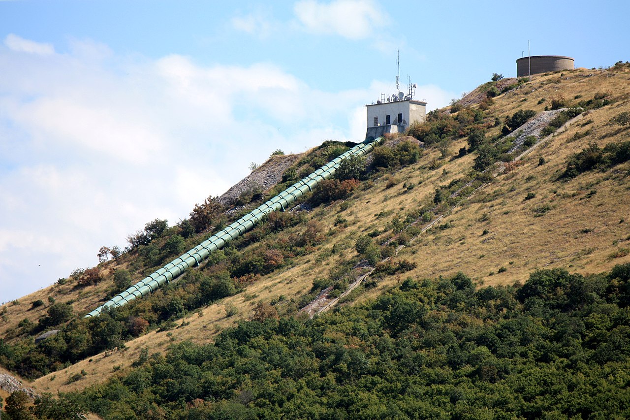
Deutsch: Oberer Teil der Rohrleitungen des Wasserkraftwerk "ВЕЦ Алеко" in Aleko Konstantinowо (Bulgarien, Oblast Pasardschik) am Hang des Berges "Gradishteto" (Градището) der "Natsionalna Elektricheska Kompania" (NEK). Das Foto wurde im August 2015 aufgenommen. IMG 9043
Български: Горната част на тръбопроводите на водноелектрическа централа "ВЕЦ Алеко" в село Алеко Константиново (България, област Пазарджик) собственост на Националната електрическа компания (НЕК) на склона на връх "Градището". Снимката е заснета през август 2015. |
| Date | |
| Source | Own work |
| Author | Reneman |
| Camera location | | View this and other nearby images on: OpenStreetMap |
|---|
Licensing
[edit]
I, the copyright holder of this work, hereby publish it under the following license:
This file is licensed under the Creative Commons Attribution-Share Alike 4.0 International license.
- You are free:
- to share – to copy, distribute and transmit the work
- to remix – to adapt the work
- Under the following conditions:
- attribution – You must give appropriate credit, provide a link to the license, and indicate if changes were made. You may do so in any reasonable manner, but not in any way that suggests the licensor endorses you or your use.
- share alike – If you remix, transform, or build upon the material, you must distribute your contributions under the same or compatible license as the original.
I have published this image as author under the Creative-Commons-Licence CC BY-SA 4.0.. This means that free usage outside of Wikimedia projects under the following terms of licence is possible:
- The image is credited with „René Kirchhoff / Wikimedia“
If this is not possible due to shortage of space, please contact me first. - If possible a weblink to the original image would be great: https://commons.wikimedia.org/wiki/File:Rohrleitungen_Wasserkraftwerk_VETS_Aleko.jpg
File history
Click on a date/time to view the file as it appeared at that time.
| Date/Time | Thumbnail | Dimensions | User | Comment | |
|---|---|---|---|---|---|
| current | 19:49, 22 August 2015 | | 3,000 × 2,000 (3.05 MB) | Reneman (talk | contribs) | User created page with UploadWizard |
You cannot overwrite this file.
File usage on Commons
The following page uses this file:
File usage on other wikis
The following other wikis use this file:
- Usage on bg.wikipedia.org
- Usage on de.wikipedia.org
- Usage on en.wikipedia.org
- Usage on uk.wikipedia.org
- Usage on www.wikidata.org