File:Rose Valley Beaver.JPG
Jump to navigation
Jump to search

Size of this preview: 359 × 599 pixels. Other resolutions: 144 × 240 pixels | 288 × 480 pixels | 460 × 768 pixels | 614 × 1,024 pixels | 1,867 × 3,113 pixels.
Original file (1,867 × 3,113 pixels, file size: 2.1 MB, MIME type: image/jpeg)
Captions
Captions
Add a one-line explanation of what this file represents
Summary
[edit]
| Description |
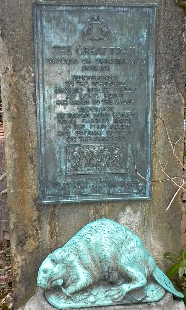
English: Pennsylvania State Historical marker from 1926, marking the site of (a branch of) the Minquas Path, an Indian Path connecting the Susquehanna River to the Delaware River, used in the 1600s and later to trade beaver pelts. Located just off 45 Rose Valley Road in Rose Valley, Pennsylvania, right next to the NRHP Thunderbird Lodge. Rose Valley is also on the NRHP as a Historic District. (The marker is specifically mentioned in the both the Rose Valley HD and Thunderbird Lodge NRHP nominations). A regular new style PHMC marker is placed right next to it, about 3 feet to the left, but out of this photo. The new marker repeats similar text as the old marker. Marker is in total about 4 feet high and easy to miss at a turn of Rose Valley Road. If you want to see it park at the Hedge Row Theater and walk about 30 yards north. Spots on the beaver are raindrops.
Beaver sculpture by Albert Laessle, 1926, see SIRIS, no visible copyright notice so public domain. |
| Date | |
| Source | Own work |
| Author | Smallbones |
Licensing
[edit]
| I, the copyright holder of this work, release this work into the public domain. This applies worldwide. In some countries this may not be legally possible; if so: I grant anyone the right to use this work for any purpose, without any conditions, unless such conditions are required by law. |
File history
Click on a date/time to view the file as it appeared at that time.
| Date/Time | Thumbnail | Dimensions | User | Comment | |
|---|---|---|---|---|---|
| current | 22:51, 3 January 2011 | | 1,867 × 3,113 (2.1 MB) | Smallbones (talk | contribs) | {{Information |Description={{en|1=Pennsylvania State Historical marker from 1926, marking the site of (a branch of) the Minquas Path, an Indian Path connecting the Susquehanna River to the Delaware River, used in the 1600's and later to trade beaver pelts |
You cannot overwrite this file.
File usage on Commons
There are no pages that use this file.
File usage on other wikis
The following other wikis use this file:
- Usage on en.wikipedia.org