File:Rotunda in skalica.JPG
Jump to navigation
Jump to search

Size of this preview: 800 × 600 pixels. Other resolutions: 320 × 240 pixels | 640 × 480 pixels | 1,024 × 768 pixels.
Original file (1,024 × 768 pixels, file size: 237 KB, MIME type: image/jpeg)
Captions
Captions
Add a one-line explanation of what this file represents
Summary
[edit]
| Description |
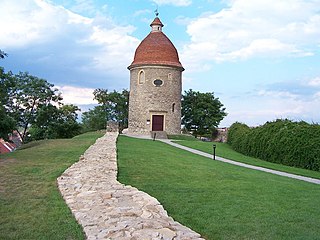
Rotunda in skalica
|
||
| Date | 10 August 2005, 17:47:00 (according to Exif data) | ||
| Source | Own work | ||
| Author | Peter Cech | ||
| Permission (Reusing this file) |
I, the copyright holder of this work, hereby publish it under the following license: This file is licensed under the Creative Commons Attribution-Share Alike 2.5 Generic license.
|
| Object location | | View this and other nearby images on: OpenStreetMap |
|---|
File history
Click on a date/time to view the file as it appeared at that time.
| Date/Time | Thumbnail | Dimensions | User | Comment | |
|---|---|---|---|---|---|
| current | 21:09, 23 March 2007 | | 1,024 × 768 (237 KB) | Peter cech (talk | contribs) |
You cannot overwrite this file.
File usage on Commons
There are no pages that use this file.
File usage on other wikis
The following other wikis use this file:
- Usage on cs.wikipedia.org
- Usage on de.wikivoyage.org
- Usage on hu.wikipedia.org
- Usage on mdf.wikipedia.org
- Usage on pl.wikivoyage.org
- Usage on sh.wikipedia.org
- Usage on sk.wikipedia.org
- Bratislavský hrad
- Trenčiansky hrad
- Červený Kameň (hrad)
- Krásna Hôrka
- Spišský hrad
- Beckov (hrad)
- Strečno (hrad)
- Devín (hrad)
- Zvolenský hrad (nový)
- Bojnický zámok
- Kaštieľ Svätý Anton
- Kaštieľ v Betliari
- Kostolec (hradisko)
- Mohyla Milana Rastislava Štefánika (Bradlo)
- Dóm svätej Alžbety
- Oravský hrad
- Mestský hrad v Banskej Bystrici
- Kaštieľ v Bytči
- Kláštor Hronský Beňadik
- Katedrála svätého Martina (Bratislava)
- Slavín (Bratislava)
- Rímsky vojenský tábor v Iži
- Molpír
- Historická lesná úvraťová železnica
- Kalište
- Červený kláštor
- Národný cintorín v Martine
- Bazilika svätého Jakuba (Levoča)
- Havránok
- Kostol Najsvätejšej Trojice (Kežmarok)
- Východoslovenské drevené kostoly
- Fortifikačný systém mesta Komárno
- Pamätník Východoslovenského roľníckeho povstania
- Bazilika svätého Egídia (Bardejov)
- Universitas Istropolitana
- Kostol svätého Juraja (Kostoľany pod Tribečom)
- Veľká lúka (Dúbravka)
- Mestský hrad v Kremnici
- Dielo Majstra Pavla z Levoče
- Kostol Ducha Svätého (Žehra)
- Župný dom (Košice)
- Rotunda svätého Juraja (Skalica)
View more global usage of this file.