File:Ružany Former Sapeha Estate XVI-XVIII - panoramio (2).jpg
Jump to navigation
Jump to search
Size of this preview: 800 × 234 pixels. Other resolutions: 320 × 94 pixels | 640 × 187 pixels | 2,000 × 585 pixels.
Original file (2,000 × 585 pixels, file size: 221 KB, MIME type: image/jpeg)
Captions
Captions
Add a one-line explanation of what this file represents
Summary
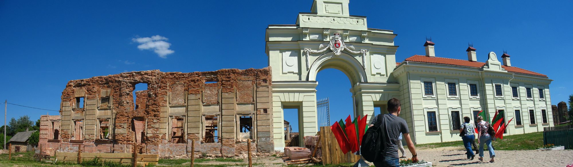
[edit]| Description | Ružany Former Sapeha Estate XVI-XVIII | ||
| Date | Taken on 5 June 2011 | ||
| Source | https://web.archive.org/web/20161023053745/http://www.panoramio.com/photo/53800092 | ||
| Author | Andrej Kuźniečyk | ||
| Permission (Reusing this file) |
This file is licensed under the Creative Commons Attribution-Share Alike 3.0 Unported license. Attribution: Andrej Kuźniečyk
|
||
| Tags (from Panoramio photo page) | Ružany, 2011, Belarus, Bieraściejščyna, Ružany |
| Camera location | | View this and other nearby images on: OpenStreetMap |
|---|

.jpg&action=edit§ion=1)
.jpg¶ms=052.859844_N_0024.895742_E_globe:Earth_type:camera_source:Panoramio_&language=en)
.jpg&action=edit&withJS=MediaWiki:Catcheck.js)
File history
Click on a date/time to view the file as it appeared at that time.
| Date/Time | Thumbnail | Dimensions | User | Comment | |
|---|---|---|---|---|---|
| current | 15:55, 26 November 2016 | 2,000 × 585 (221 KB) | Panoramio upload bot (talk | contribs) | == {{int:filedesc}} == {{Information |description=Ružany Former Sapeha Estate XVI-XVIII |date={{Taken on|2011-06-05}} |source=http://www.panoramio.com/photo/53800092 |author=[http://www.panoramio.com/user/416171?with_photo_id=53800092 Andrej Kuźnieč... |
You cannot overwrite this file.
File usage on Commons
There are no pages that use this file.
.jpg&oldid=663069629)