File:Ruborough Camp Somerset Map.jpg
跳转到导航
跳转到搜索
没有更高的分辨率。
Ruborough_Camp_Somerset_Map.jpg (570 × 535像素,文件大小:48 KB,MIME类型:image/jpeg)
说明
说明
添加一行文字以描述该文件所表现的内容
摘要
[编辑]
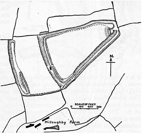
| 描述 | Map of earthworks at Ruborough Camp, Quantock Hills, Somerset, England. |
| 日期 | |
| 来源 | The Victoria History of the Counties of England, A History Of Somerset, Volume 2. |
| 作者 | Editor - W.Page; Chapter on Ancient Earthworks - C.H.Bothamley |
| 授权 (二次使用本文件) |
Copyright has expired in the United Kingdom, and is believed to be in the public domain. |
许可协议
[编辑]
|
本作品在其来源国以及其他著作权期限是作者逝世后70年或以下的国家和地区属于公有领域。 | |
| 本文件已被确认为免除已知的著作权法限制(包括所有相关权利)。 | |
文件历史
点击某个日期/时间查看对应时刻的文件。
| 日期/时间 | 缩略图 | 大小 | 用户 | 备注 | |
|---|---|---|---|---|---|
| 当前 | 2006年12月10日 (日) 14:12 | | 570 × 535(48 KB) | Mikhailfranco~commonswiki(留言 | 贡献) | {{Information |Description=Map of earthworks at Ruborough Camp, Quantock Hills, Somerset, England. |Source=The Victoria History of the Counties of England, A History Of Somerset, Volume 2. |Date=1911 |Author=Editor - W.Page; Chapter on Ancient Earthworks |
您不可以覆盖此文件。
文件用途
没有页面使用本文件。
全域文件用途
以下其他wiki使用此文件:
- en.wikipedia.org上的用途
- www.wikidata.org上的用途
- zh.wikipedia.org上的用途