File:Rumeli Fortress.jpg
Original file (1,000 × 382 pixels, file size: 483 KB, MIME type: image/jpeg)
Captions
Captions
Summary
[edit]
| Description |
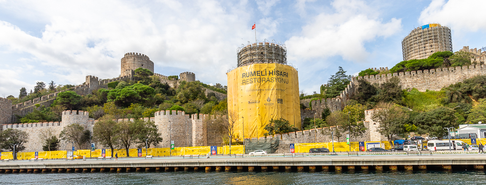
English: Rumelihisarı (also known as Rumelian Castle and Roumeli Hissar Castle[1]) or Boğazkesen Castle (meaning "Strait-Blocker Castle" or literally "Throat-Cutter Castle") is a medieval fortress located in Istanbul, Turkey, on a series of hills on the European banks of the Bosphorus. The fortress also lends its name to the immediate neighborhood around it in the city's Sarıyer district.
Conceived and built between 1451 and 1452 on the orders of Ottoman Sultan Mehmed II, the complex was commissioned in preparation for a planned Ottoman siege on the then-Byzantine city of Constantinople,[1] with the goal of cutting off maritime military and logistical relief that could potentially come to the Byzantines' aid by way of the Bosphorus Strait, hence the fortress's alternative name, "Boğazkesen", i.e. "Strait-cutter" Castle. Its older sister structure, Anadoluhisari ("Anatolian Fortress"), sits on the opposite banks of the Bosporus, and the two fortresses worked in tandem during the final siege to throttle all naval traffic along the Bosphorus, thus helping the Ottomans achieve their goal of making the city of Constantinople (later renamed Istanbul) their new imperial capital in 1453. After the Ottoman conquest of the city, Rumelihisarı served as a customs checkpoint and occasional prison, notably for the embassies of states that were at war with the Empire. After suffering extensive damage in the Great Earthquake of 1509, the structure was repaired, and was used continuously until the late 19th century. Today, the fortress is a popular museum open to the public, and further acts as an open-air venue for seasonal concerts, art festivals, and special events. Source: Wikipedia |
| Date | |
| Source | Own work |
| Author | Julia Sumangil |
| Camera location | | View this and other nearby images on: OpenStreetMap |
|---|
Licensing
[edit]
- You are free:
- to share – to copy, distribute and transmit the work
- to remix – to adapt the work
- Under the following conditions:
- attribution – You must give appropriate credit, provide a link to the license, and indicate if changes were made. You may do so in any reasonable manner, but not in any way that suggests the licensor endorses you or your use.
- share alike – If you remix, transform, or build upon the material, you must distribute your contributions under the same or compatible license as the original.
File history
Click on a date/time to view the file as it appeared at that time.
| Date/Time | Thumbnail | Dimensions | User | Comment | |
|---|---|---|---|---|---|
| current | 00:14, 15 February 2023 | 1,000 × 382 (483 KB) | Julia Sumangil (talk | contribs) | Uploaded own work with UploadWizard |
You cannot overwrite this file.
File usage on Commons
There are no pages that use this file.