File:Rummu karjäär2.jpg
Jump to navigation
Jump to search
Size of this preview: 800 × 394 pixels. Other resolutions: 320 × 158 pixels | 640 × 316 pixels | 1,024 × 505 pixels | 1,280 × 631 pixels | 2,560 × 1,262 pixels | 7,170 × 3,535 pixels.
Original file (7,170 × 3,535 pixels, file size: 16.27 MB, MIME type: image/jpeg)
Captions
Captions
Add a one-line explanation of what this file represents
Summary[edit]
| Description |
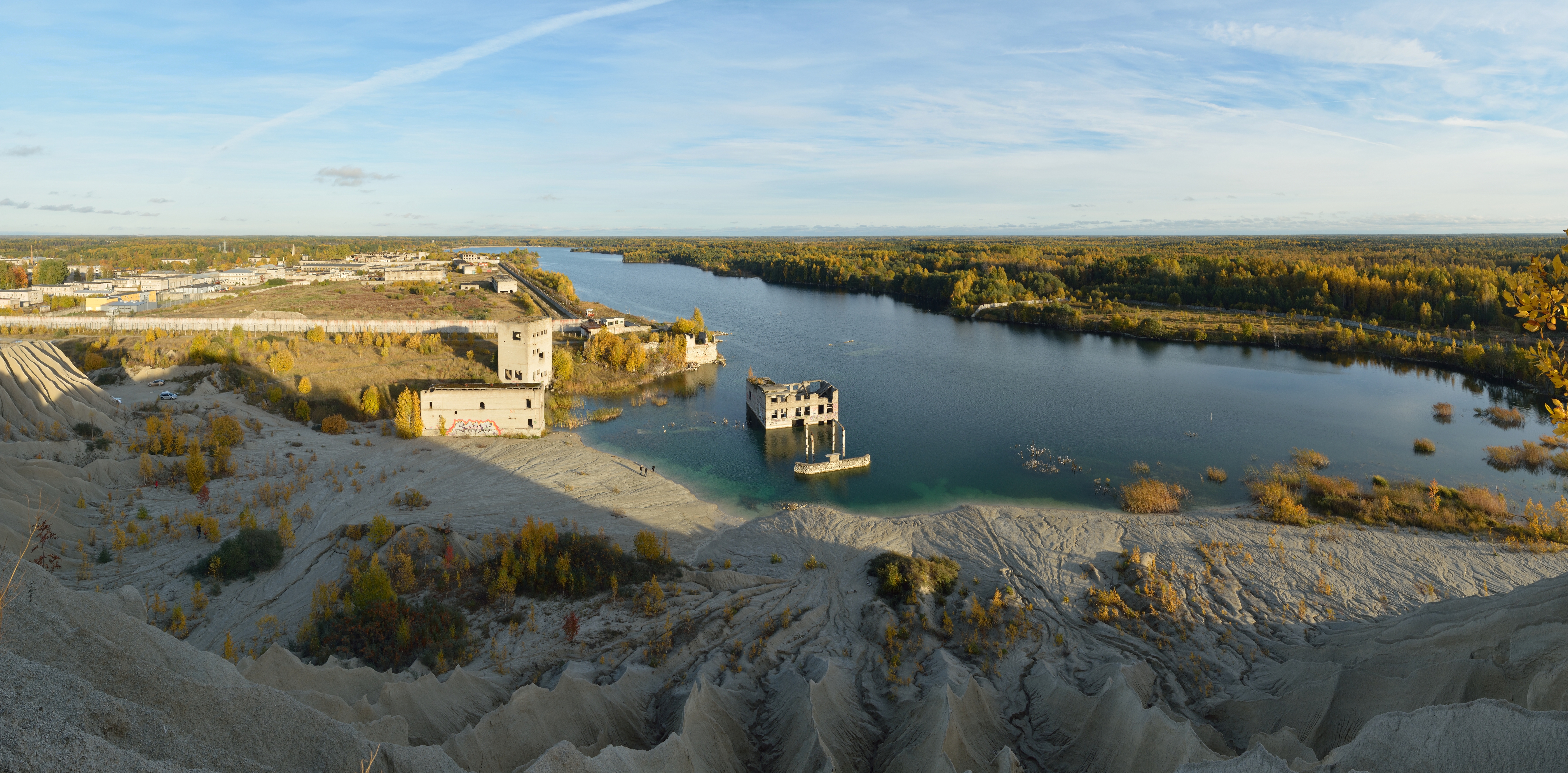
Eesti: Rummu karjäär. Rummu karjääris alustati kaevandamist 1938. aastal, kui alustas tööd Vasalemma Lubja- ja Marmoritehas asukohaga Rummul, mis kasutas tööjõuks vange. Kuna vee ärajuhtimine karjäärist 1990. aastatel lõpetati, hakkas põhjaveetase tõusma. Murru vangla suleti 2012. a lõpus. English: Rummu quarry, Rummu, Estonia. Limestone mining quarry was established in 1938. Limestone was mined by convicts of the adjacent Murru prison until the restoration of Estonian independence. The quarry filled up by natural water after mining was no longer necessary and draining of water was stopped. Abandonment of the quarry happened so fast that some machinery was sunken along with the building complex. The prison itself remained active until the end of 2012. |
| Date | |
| Source | Own work |
| Author | Ivar Leidus |
| Other versions |
|
| Camera location | | View this and other nearby images on: OpenStreetMap |
|---|
| Camera Model | Nikon D5200 |
|---|---|
| Shutter speed | 1/125; |
| Aperture | f/8; |
| Film speed (ISO) | 125; |
| Focal length | 17 mm; |
This image was created with Hugin.
Licensing[edit]
I, the copyright holder of this work, hereby publish it under the following license:
This file is licensed under the Creative Commons Attribution-Share Alike 3.0 Unported license.
- You are free:
- to share – to copy, distribute and transmit the work
- to remix – to adapt the work
- Under the following conditions:
- attribution – You must give appropriate credit, provide a link to the license, and indicate if changes were made. You may do so in any reasonable manner, but not in any way that suggests the licensor endorses you or your use.
- share alike – If you remix, transform, or build upon the material, you must distribute your contributions under the same or compatible license as the original.
| Annotations | This image is annotated: View the annotations at Commons |
File history
Click on a date/time to view the file as it appeared at that time.
| Date/Time | Thumbnail | Dimensions | User | Comment | |
|---|---|---|---|---|---|
| current | 19:23, 6 October 2013 | | 7,170 × 3,535 (16.27 MB) | Iifar (talk | contribs) | User created page with UploadWizard |
You cannot overwrite this file.
File usage on Commons
The following 4 pages use this file:
File usage on other wikis
The following other wikis use this file:
- Usage on et.wikipedia.org
- Usage on hu.wikipedia.org
- Usage on lv.wikipedia.org
- Usage on www.wikidata.org