File:Sóstó fűrdő - panoramio.jpg
Jump to navigation
Jump to search

Size of this preview: 800 × 457 pixels. Other resolutions: 320 × 183 pixels | 640 × 366 pixels | 1,024 × 585 pixels | 1,451 × 829 pixels.
Original file (1,451 × 829 pixels, file size: 304 KB, MIME type: image/jpeg)
Captions
Captions
Add a one-line explanation of what this file represents
Summary
[edit]
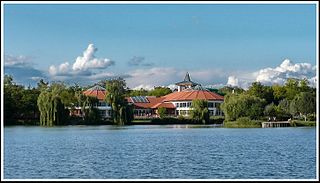
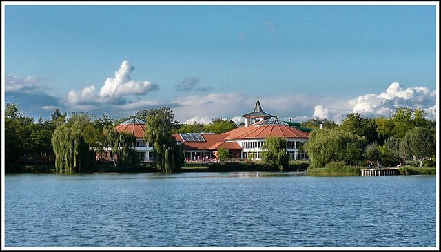
| Description | Sóstó fűrdő | ||
| Date | 8 July 2010 (original upload date) | ||
| Source | https://web.archive.org/web/20161015102714/http://www.panoramio.com/photo/37679869 | ||
| Author | Szemes Elek | ||
| Permission (Reusing this file) |
This file is licensed under the Creative Commons Attribution-Share Alike 3.0 Unported license. Attribution: Szemes Elek
|
||
| Tags (from Panoramio photo page) | Nyíregyháza, Sóstófürdő, Tájkép |
| Camera location | | View this and other nearby images on: OpenStreetMap |
|---|
File history
Click on a date/time to view the file as it appeared at that time.
| Date/Time | Thumbnail | Dimensions | User | Comment | |
|---|---|---|---|---|---|
| current | 20:28, 15 December 2016 | | 1,451 × 829 (304 KB) | Panoramio upload bot (talk | contribs) | == {{int:filedesc}} == {{Information |description=Sóstó fűrdő |date={{Original upload date|2010-07-08}} |source=http://www.panoramio.com/photo/37679869 |author=[http://www.panoramio.com/user/284747?with_photo_id=37679869 Szemes Elek] |permission={{... |
You cannot overwrite this file.
File usage on Commons
There are no pages that use this file.