File:SA-Election2018-state-map.png
Jump to navigation
Jump to search

Size of this preview: 429 × 600 pixels. Other resolutions: 172 × 240 pixels | 343 × 480 pixels | 549 × 768 pixels | 732 × 1,024 pixels | 1,889 × 2,641 pixels.
Original file (1,889 × 2,641 pixels, file size: 266 KB, MIME type: image/png)
Captions
Captions
Add a one-line explanation of what this file represents
Summary
[edit]
| Description |
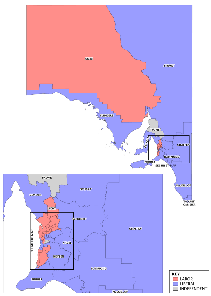
English: Map of electoral districts in the state of South Australia, coloured to represent the party winning the seat at the 2014 South Australian state election and changes since. Inset to Metro map refers to File:SA-Election2014-adelaide-map.png. |
| Date | |
| Source | Own work. Uses data from data.sa |
| Author | Canley |
Licensing
[edit]
I, the copyright holder of this work, hereby publish it under the following license:
This file is licensed under the Creative Commons Attribution-Share Alike 3.0 Unported license.
- You are free:
- to share – to copy, distribute and transmit the work
- to remix – to adapt the work
- Under the following conditions:
- attribution – You must give appropriate credit, provide a link to the license, and indicate if changes were made. You may do so in any reasonable manner, but not in any way that suggests the licensor endorses you or your use.
- share alike – If you remix, transform, or build upon the material, you must distribute your contributions under the same or compatible license as the original.
File history
Click on a date/time to view the file as it appeared at that time.
| Date/Time | Thumbnail | Dimensions | User | Comment | |
|---|---|---|---|---|---|
| current | 15:29, 17 August 2016 | | 1,889 × 2,641 (266 KB) | Timeshift9 (talk | contribs) | crop sides |
| 04:03, 13 December 2014 |  | 2,006 × 2,746 (98 KB) | Canley (talk | contribs) | Rendered from original file | |
| 02:34, 13 December 2014 |  | 2,006 × 2,746 (270 KB) | Timeshift9 (talk | contribs) | fisher | |
| 08:37, 27 May 2014 |  | 2,006 × 2,746 (98 KB) | Canley (talk | contribs) | Changed Waite to Independent | |
| 07:44, 27 May 2014 |  | 2,006 × 2,764 (282 KB) | Timeshift9 (talk | contribs) | =={{int:filedesc}}== {{Information |description={{en|1=Map of electoral districts in the state of South Australia, coloured to represent the party winning the seat at the 2014 South Australian state election and changes since. Inset to Metro map refers... |
You cannot overwrite this file.
File usage on Commons
There are no pages that use this file.
File usage on other wikis
The following other wikis use this file:
- Usage on en.wikipedia.org