File:Saarland location map 02.svg
跳至導覽
跳至搜尋

此 SVG 檔案的 PNG 預覽的大小:658 × 540 像素。 其他解析度:293 × 240 像素 | 585 × 480 像素 | 936 × 768 像素 | 1,248 × 1,024 像素 | 2,496 × 2,048 像素。
原始檔案 (SVG 檔案,表面大小:658 × 540 像素,檔案大小:125 KB)
說明
說明
添加單行說明來描述出檔案所代表的內容
摘要
[編輯]
| 描述 |
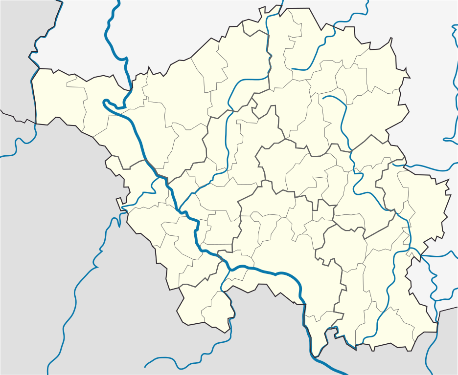
English: Position map of the state of Saarland with the six disticts and fiftytwo municipalities
Geographic limits of the map: * N: 49.65° N * S: 49.09° N * W: 6.3° E * E: 7.405° E Deutsch: Positionskarte vom Bundesland Saarland mit seinen sechs Kreisen und 52 Gemeinden Quadratische Plattkarte. Geographische Begrenzung der Karte: * N: 49.65° N * S: 49.09° N * W: 6.3° E * E: 7.405° E |
| 日期 | |
| 來源 |
自己的作品, based on: |
| 作者 |
TUBS |
| 其他版本 |
 |
授權條款
[編輯]
我,本作品的著作權持有者,決定用以下授權條款發佈本作品:
此檔案採用共享創意 姓名標示-相同方式分享 3.0 未在地化版本授權條款。
- 您可以自由:
- 分享 – 複製、發佈和傳播本作品
- 重新修改 – 創作演繹作品
- 惟需遵照下列條件:
- 姓名標示 – 您必須指名出正確的製作者,和提供授權條款的連結,以及表示是否有對內容上做出變更。您可以用任何合理的方式來行動,但不得以任何方式表明授權條款是對您許可或是由您所使用。
- 相同方式分享 – 如果您利用本素材進行再混合、轉換或創作,您必須基於如同原先的相同或兼容的條款,來分布您的貢獻成品。
檔案歷史
點選日期/時間以檢視該時間的檔案版本。
| 日期/時間 | 縮圖 | 尺寸 | 用戶 | 備註 | |
|---|---|---|---|---|---|
| 目前 | 2010年3月22日 (一) 15:09 | | 658 × 540(125 KB) | TUBS(對話 | 貢獻) | == {{int:filedesc}} == {{Information |Description={{en|1=Position map of the state of Saarland with the six disticts and fiftytwo municipalities<br> Geographic limits of the map: * N: 49.65° N * S: 49.09° N * W: 6.3° E * E: 7.405° E}} {{de|1=Positions |
無法覆蓋此檔案。
檔案用途
下列6個頁面有用到此檔案:
- File:Saarland, administrative divisions - Nmbrs - colored.svg
- File:Saarland, administrative divisions - Nmbrs - monochrome.svg
- File:Saarland, administrative divisions - de - colored.svg
- File:Saarland, administrative divisions - de - monochrome.svg
- File:Saarland Kreise Namen.png
- File:Saarland location map.svg
全域檔案使用狀況
以下其他 wiki 使用了這個檔案:
- ar.wikipedia.org 的使用狀況
- ceb.wikipedia.org 的使用狀況
- dsb.wikipedia.org 的使用狀況
- en.wikipedia.org 的使用狀況
- Saarbrücken
- Wallerfangen
- Saarlouis
- Lebach
- Saarwellingen
- Sankt Wendel
- Heusweiler
- Überherrn
- Weiskirchen
- Homburg, Saarland
- Wadern
- Dillingen, Saarland
- Dudweiler
- Sankt Ingbert
- Merzig
- Beckingen
- Losheim am See
- Mettlach
- Perl, Saarland
- Neunkirchen, Saarland
- Ottweiler
- Eppelborn
- Illingen, Saarland
- Merchweiler
- Schiffweiler
- Spiesen-Elversberg
- Bous, Germany
- Schwalbach, Saarland
- Ensdorf, Saarland
- Nalbach
- Rehlingen-Siersburg
- Schmelz
- Wadgassen
- Friedrichsthal
- Püttlingen
- Sulzbach, Saarland
- Völklingen
- Großrosseln
- Kleinblittersdorf
- Quierschied
- Riegelsberg
- Bexbach
- Blieskastel
- Gersheim
- Kirkel
- Mandelbachtal
- Freisen
檢視此檔案的更多全域使用狀況。