File:Saint-Wandrille-Rançon Eglise StMichel R01.jpg
Original file (4,871 × 3,383 pixels, file size: 10.32 MB, MIME type: image/jpeg)
Captions
Summary
[edit]DescriptionSaint-Wandrille-Rançon Eglise StMichel R01.jpg |
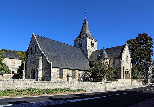
Français : Saint-Wandrille-Rançon (commune de Rives-en-Seine, département de Seine-Maritime, France) : l'église Saint-Michel
Nederlands: Saint-Wandrille-Rançon (gem. Rives-en-Seine, departement Seine-Maritime, Frankrijk): de Sint-Michaelkerk
English: Saint-Wandrille-Rançon (municipality of Rives-en-Seine, Seine-Maritime departmen, France): Saint Michael church |
Date | |
Source | Own work |
Author | Marc Ryckaert |
Camera location | 49° 31′ 40.41″ N, 0° 46′ 01.27″ E | View this and other nearby images on: OpenStreetMap | 49.527892; 0.767020 |
---|
This building is indexed in the base Mérimée, a database of architectural heritage maintained by the French Ministry of Culture, under the reference IA00021411 .
brezhoneg ∙ català ∙ Deutsch ∙ English ∙ español ∙ Esperanto ∙ euskara ∙ français ∙ italiano ∙ magyar ∙ Nederlands ∙ português do Brasil ∙ português ∙ română ∙ sicilianu ∙ slovenščina ∙ suomi ∙ svenska ∙ Ελληνικά ∙ беларуская (тарашкевіца) ∙ македонски ∙ русский ∙ українська ∙ বাংলা ∙ +/− |
Licensing
[edit]- You are free:
- to share – to copy, distribute and transmit the work
- to remix – to adapt the work
- Under the following conditions:
- attribution – You must give appropriate credit, provide a link to the license, and indicate if changes were made. You may do so in any reasonable manner, but not in any way that suggests the licensor endorses you or your use.
- share alike – If you remix, transform, or build upon the material, you must distribute your contributions under the same or compatible license as the original.
This image was uploaded as part of Wiki Loves Monuments 2019.
Afrikaans ∙ Alemannisch ∙ azərbaycanca ∙ Bahasa Indonesia ∙ Bahasa Melayu ∙ Bikol Central ∙ bosanski ∙ brezhoneg ∙ català ∙ čeština ∙ Cymraeg ∙ dansk ∙ davvisámegiella ∙ Deutsch ∙ eesti ∙ English ∙ español ∙ Esperanto ∙ euskara ∙ français ∙ Frysk ∙ Gaeilge ∙ galego ∙ hrvatski ∙ Ido ∙ italiano ∙ latviešu ∙ Lëtzebuergesch ∙ Malagasy ∙ magyar ∙ Malti ∙ Nederlands ∙ norsk ∙ norsk nynorsk ∙ norsk bokmål ∙ polski ∙ português ∙ português do Brasil ∙ română ∙ shqip ∙ sicilianu ∙ slovenčina ∙ slovenščina ∙ suomi ∙ svenska ∙ Tagalog ∙ Türkçe ∙ Yorùbá ∙ Zazaki ∙ Ελληνικά ∙ беларуская ∙ беларуская (тарашкевіца) ∙ български ∙ кыргызча ∙ македонски ∙ русский ∙ српски / srpski ∙ українська ∙ ქართული ∙ հայերեն ∙ नेपाली ∙ हिन्दी ∙ বাংলা ∙ മലയാളം ∙ ไทย ∙ 한국어 ∙ +/− |
File history
Click on a date/time to view the file as it appeared at that time.
Date/Time | Thumbnail | Dimensions | User | Comment | |
---|---|---|---|---|---|
current | 16:54, 23 September 2019 | 4,871 × 3,383 (10.32 MB) | MJJR (talk | contribs) | User created page with UploadWizard |
You cannot overwrite this file.
File usage on Commons
There are no pages that use this file.
Metadata
This file contains additional information such as Exif metadata which may have been added by the digital camera, scanner, or software program used to create or digitize it. If the file has been modified from its original state, some details such as the timestamp may not fully reflect those of the original file. The timestamp is only as accurate as the clock in the camera, and it may be completely wrong.
Camera manufacturer | Canon |
---|---|
Camera model | Canon EOS 6D |
Author | Marc Ryckaert |
Exposure time | 1/640 sec (0.0015625) |
F-number | f/7.1 |
ISO speed rating | 100 |
Date and time of data generation | 12:04, 20 September 2019 |
Lens focal length | 24 mm |
Latitude | 49° 31′ 40.41″ N |
Longitude | 0° 46′ 1.27″ E |
Altitude | 18.8 meters above sea level |
Orientation | Normal |
Horizontal resolution | 350 dpi |
Vertical resolution | 350 dpi |
Software used | Adobe Photoshop Elements 6.0 Macintosh |
File change date and time | 18:50, 23 September 2019 |
Y and C positioning | Centered |
Exif version | 2.3 |
Date and time of digitizing | 12:04, 20 September 2019 |
Meaning of each component |
|
APEX shutter speed | 9.375 |
APEX aperture | 5.625 |
APEX exposure bias | 0 |
Flash | Flash did not fire, compulsory flash suppression |
Supported Flashpix version | 1 |
Color space | sRGB |
Focal plane X resolution | 3,810.5849582173 |
Focal plane Y resolution | 3,815.89958159 |
Focal plane resolution unit | inches |
Custom image processing | Normal process |
Exposure mode | Auto exposure |
White balance | Auto white balance |
Scene capture type | Standard |
GPS time (atomic clock) | 10:01 |
Satellites used for measurement | 12 |
Receiver status | Measurement in progress |
Geodetic survey data used | WGS-84 |
GPS date | 20 September 2019 |
GPS tag version | 0.0.3.2 |
Supported Flashpix version | 1 |
Image width | 4,871 px |
Image height | 3,383 px |
Rating (out of 5) | 0 |
Date metadata was last modified | 20:50, 23 September 2019 |
Structured data
Items portrayed in this file
depicts
some value
49°31'40.411"N, 0°46'1.272"E
20 September 2019
0.0015625 second
7.1
24 millimetre
100
image/jpeg
- Base Mérimée
- Monuments à l’inventaire
- Mérimée with IA parameter
- Cultural heritage monuments in France with known IDs
- CC-BY-SA-4.0
- Self-published work
- Images from Wiki Loves Monuments 2019
- Images from Wiki Loves Monuments 2019 in France
- Taken with Canon EOS 6D
- Images by MJJR
- Uploaded via Campaign:wlm-fr
- France photographs taken on 2019-09-20