File:Salmon River, U.S. 95 Between RIggins and Grangeville, Idaho - 31499345337.jpg

Original file (5,184 × 2,752 pixels, file size: 11.07 MB, MIME type: image/jpeg)
Captions
Captions
Summary
[edit]
| Description |
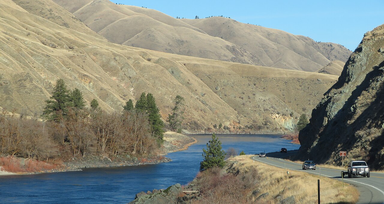
English: The Salmon River is located in Idaho in the northwestern United States. The Salmon is also known as "The River of No Return". It flows for 425 miles (685 km) through central Idaho, draining a rugged, thinly populated watershed of 14,000 square miles (36,000 km2) and dropping more than 7,000 feet (2,100 m) between its headwaters, near Galena Summit above the Sawtooth Valley in the Sawtooth National Recreation Area, and its confluence with the Snake River. Measured at White Bird, its average discharge is 11,060 cubic feet per second (82,700 US gal/s; 313 m3/s). It is one of the largest rivers in the continental United States without a single dam on its mainstem.
Cities located along the Salmon River include Stanley, Clayton, Challis, Salmon, Riggins, and White Bird. Redfish Lake and Little Redfish Lake near Stanley, which flow into the river via Redfish Lake Creek, are the terminus of the longest Pacific sockeye salmon migration in North America. The lower half of the river provides the time zone boundary for the state, with northern Idaho on Pacific time and the rest of the state on Mountain time. The Salmon River originates from and flows through the mountains of central and eastern Idaho (Lemhi Range, Sawtooth, Salmon River Mountains, Clearwater and Bitterroot Range). The main stem rises in the Sawtooth Range at over 9,200 feet (2,800 m) in elevation, several miles northwest of Norton Peak. For the first 30 miles (50 km), it flows north through the Sawtooth Valley, then turns east at Stanley, receiving the Yankee Fork shortly below that point and the East Fork further downstream. The river then flows northeast, receiving the Pahsimeroi River at Ellis and then the Lemhi River at Salmon, Idaho east of the Lemhi Range. North of Salmon, the river is joined by the North Fork, before turning west into over 200 miles (320 km) of continuous canyons through the Salmon River and Clearwater Mountains – some of the most rugged and isolated terrain in the contiguous United States. Exhibiting upwards of 7,000 feet (2,130 m) of vertical relief, the Salmon River canyons are some of the deepest in the U.S., surpassing the Grand Canyon and second only to the Snake River's Hells Canyon on the Idaho–Oregon border. Here, the river is joined by its two largest tributaries, the Middle Fork and South Fork. Ten miles (16 km) downstream (west) of its confluence with the Middle Fork, the Salmon River becomes the dividing line for the two time zones in Idaho: Mountain time to the south, Pacific time to the north, bisecting the state at approximately 45½ degrees north latitude. The river turns abruptly north at the confluence with the Little Salmon River at Riggins, about 87 miles (140 km) above its mouth. From there the river flows almost due north, with U.S. Route 95 on its east bank until a few miles before White Bird; the river then loops northwest and south to its confluence with the Snake River north of Hells Canyon, 15 miles (25 km) south of the Washington border and 40 miles (65 km) south of Lewiston. The Salmon River is the longest river system contained entirely within a single U.S. state. en.wikipedia.org/wiki/Salmon_River_(Idaho) en.wikipedia.org/wiki/Wikipedia:Text_of_Creative_Commons_... |
| Date | Taken on 22 December 2018, 11:35:17 |
| Source | https://www.flickr.com/photos/kenlund/31499345337/ |
| Author | Ken Lund |
Licensing
[edit]
- You are free:
- to share – to copy, distribute and transmit the work
- to remix – to adapt the work
- Under the following conditions:
- attribution – You must give appropriate credit, provide a link to the license, and indicate if changes were made. You may do so in any reasonable manner, but not in any way that suggests the licensor endorses you or your use.
- share alike – If you remix, transform, or build upon the material, you must distribute your contributions under the same or compatible license as the original.
| This image was originally posted to Flickr by Ken Lund at https://flickr.com/photos/75683070@N00/31499345337. It was reviewed on 26 March 2024 by FlickreviewR 2 and was confirmed to be licensed under the terms of the cc-by-sa-2.0. |
File history
Click on a date/time to view the file as it appeared at that time.
| Date/Time | Thumbnail | Dimensions | User | Comment | |
|---|---|---|---|---|---|
| current | 03:47, 26 March 2024 | | 5,184 × 2,752 (11.07 MB) | Salmoonlight (talk | contribs) | Uploaded a work by Ken Lund from https://www.flickr.com/photos/kenlund/31499345337/ with UploadWizard |
You cannot overwrite this file.
File usage on Commons
There are no pages that use this file.