File:Salmon Turrell Farmhouse.jpg
Jump to navigation
Jump to search

Size of this preview: 800 × 600 pixels. Other resolutions: 320 × 240 pixels | 640 × 480 pixels | 1,024 × 768 pixels | 1,280 × 960 pixels | 2,560 × 1,920 pixels | 2,816 × 2,112 pixels.
Original file (2,816 × 2,112 pixels, file size: 2.9 MB, MIME type: image/jpeg)
Captions
Captions
Add a one-line explanation of what this file represents
|
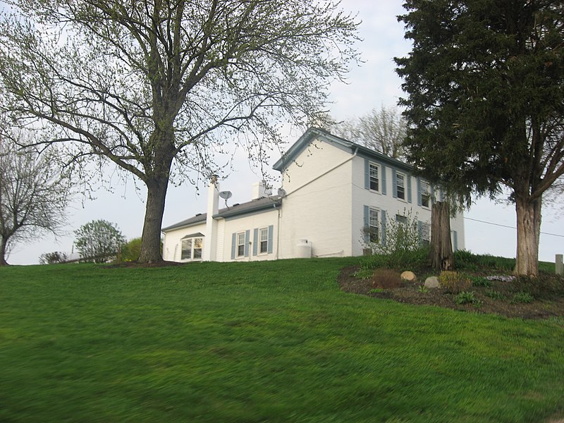
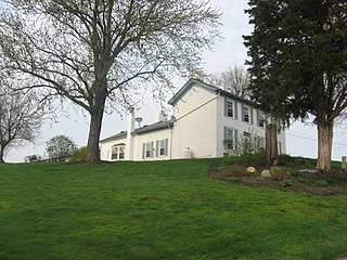
This is an image of a place or building that is listed on the National Register of Historic Places in the United States of America. Its reference number is 09000423. |
| Camera location | | View this and other nearby images on: OpenStreetMap |
|---|
| Description |
English: Front and western side of the farmhouse at the Salmon Turrell Farmstead, located at 3051 Snow Hill Road northwest of Rockdale in Whitewater Township, Franklin County, Indiana, United States. Built in 1820, the farmstead is listed on the National Register of Historic Places. |
||
| Date | Taken on 19 March 2012 | ||
| Source | Own work | ||
| Author | Nyttend | ||
| Permission (Reusing this file) |
|
File history
Click on a date/time to view the file as it appeared at that time.
| Date/Time | Thumbnail | Dimensions | User | Comment | |
|---|---|---|---|---|---|
| current | 11:49, 29 March 2012 | | 2,816 × 2,112 (2.9 MB) | Nyttend (talk | contribs) | {{NRHP|09000423}} {{Location|39|19|39|N|84|51|37|W}} {{Information |Description={{en|Front and western side of the farmhouse at the {{w|Salmon Turrell Farmstead}}, located along Snow Hill Road northwest of {{w|Rockdale, Indiana|Rockdale}} in {{w|Whitew... |
You cannot overwrite this file.
File usage on Commons
There are no pages that use this file.
File usage on other wikis
The following other wikis use this file:
- Usage on en.wikipedia.org
- Usage on www.wikidata.org
Metadata
Categories:
- Houses built in Indiana in 1820
- Brick houses in Franklin County, Indiana
- Farmhouses in Indiana
- Federal architecture in Indiana
- I-houses in Indiana
- National Register of Historic Places in Franklin County, Indiana
- March 2012 in Indiana
- Views from automobiles in Indiana
- Rockdale, Indiana
- Views of Franklin County, Indiana