File:Sam 2021-10-01 1442Z.jpg
Jump to navigation
Jump to search

Size of this preview: 465 × 600 pixels. Other resolutions: 186 × 240 pixels | 372 × 480 pixels | 595 × 768 pixels | 793 × 1,024 pixels | 1,587 × 2,048 pixels | 6,200 × 8,000 pixels.
Original file (6,200 × 8,000 pixels, file size: 28.43 MB, MIME type: image/jpeg)
Captions
Captions
Add a one-line explanation of what this file represents
Summary[edit]
| Description |
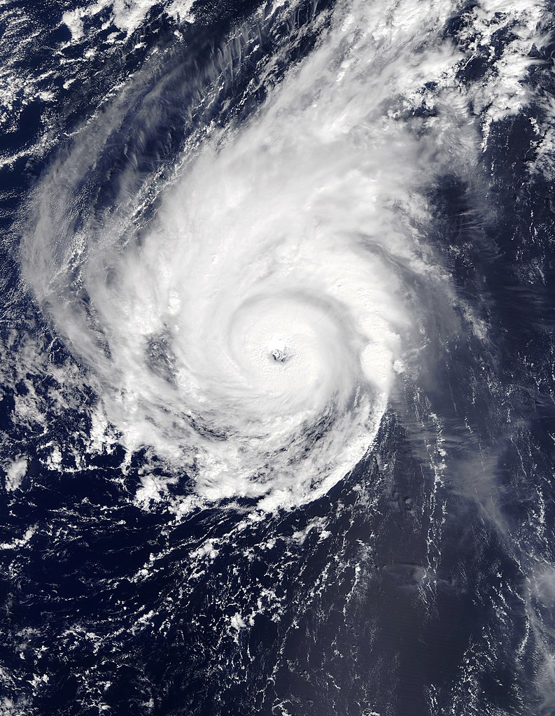
English: Hurricane Sam at its secondary peak intensity southeast of Bermuda on October 1, 2021. |
| Date | |
| Source | https://worldview.earthdata.nasa.gov/ |
| Author | NASA/Terra-MODIS |
Licensing[edit]
| This file is in the public domain in the United States because it was solely created by NASA. NASA copyright policy states that "NASA material is not protected by copyright unless noted". (See Template:PD-USGov, NASA copyright policy page or JPL Image Use Policy.) | ||
 |
Warnings:
|
File history
Click on a date/time to view the file as it appeared at that time.
| Date/Time | Thumbnail | Dimensions | User | Comment | |
|---|---|---|---|---|---|
| current | 15:27, 23 June 2022 | | 6,200 × 8,000 (28.43 MB) | TheWxResearcher (talk | contribs) | I believe this is the lossless version |
| 23:35, 16 February 2022 |  | 6,000 × 8,000 (10.92 MB) | TheWxResearcher (talk | contribs) | Adjusted levels. | |
| 17:56, 14 January 2022 |  | 6,000 × 8,000 (8.84 MB) | TheWxResearcher (talk | contribs) | Rounded the pixels | |
| 15:10, 2 October 2021 |  | 5,997 × 8,007 (6.9 MB) | TheWxResearcher (talk | contribs) | Uploaded a work by NASA/Terra-MODIS from https://worldview.earthdata.nasa.gov/ with UploadWizard |
You cannot overwrite this file.
File usage on Commons
The following page uses this file:
File usage on other wikis
The following other wikis use this file:
- Usage on en.wikipedia.org
- Usage on pt.wikipedia.org