File:SanJoaquinRiverMap.jpg
Jump to navigation
Jump to search

Size of this preview: 598 × 599 pixels. Other resolutions: 240 × 240 pixels | 479 × 480 pixels | 767 × 768 pixels | 1,092 × 1,094 pixels.
Original file (1,092 × 1,094 pixels, file size: 1.24 MB, MIME type: image/jpeg)
Captions
Captions
Add a one-line explanation of what this file represents
Summary
[edit]
| Description |
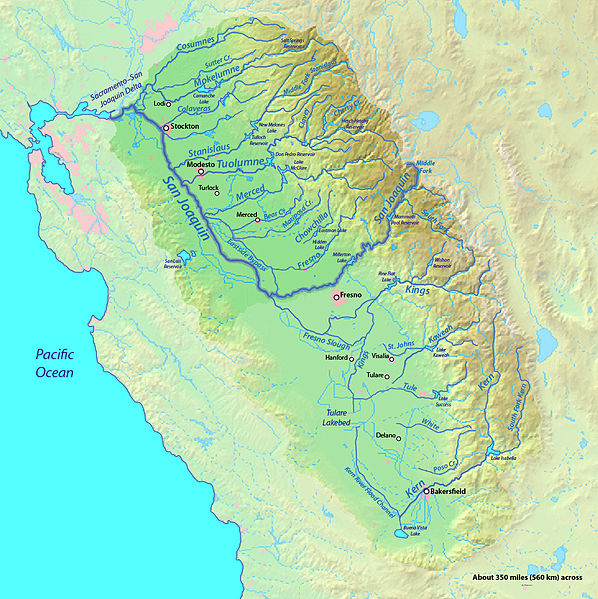
English: Map of the San Joaquin River watershed, which drains most of central inland California into the Pacific |
| Date | |
| Source | Background from http://www2.demis.nl/mapserver/mapper.asp |
| Author | Background layer attributed to DEMIS Mapserver, map created by Shannon1 |
| Permission (Reusing this file) |
Map created from DEMIS Mapserver, which are public domain. |
Licensing
[edit]
I, the copyright holder of this work, hereby publish it under the following licenses:

|
Permission is granted to copy, distribute and/or modify this document under the terms of the GNU Free Documentation License, Version 1.2 or any later version published by the Free Software Foundation; with no Invariant Sections, no Front-Cover Texts, and no Back-Cover Texts. A copy of the license is included in the section entitled GNU Free Documentation License. |
This file is licensed under the Creative Commons Attribution-Share Alike Attribution-Share Alike 4.0 International, 3.0 Unported, 2.5 Generic, 2.0 Generic and 1.0 Generic license.
- You are free:
- to share – to copy, distribute and transmit the work
- to remix – to adapt the work
- Under the following conditions:
- attribution – You must give appropriate credit, provide a link to the license, and indicate if changes were made. You may do so in any reasonable manner, but not in any way that suggests the licensor endorses you or your use.
- share alike – If you remix, transform, or build upon the material, you must distribute your contributions under the same or compatible license as the original.
You may select the license of your choice.
File history
Click on a date/time to view the file as it appeared at that time.
| Date/Time | Thumbnail | Dimensions | User | Comment | |
|---|---|---|---|---|---|
| current | 20:14, 8 September 2012 | | 1,092 × 1,094 (1.24 MB) | Shannon1 (talk | contribs) | increased resolution and fixed some river courses in tulare basin |
| 04:31, 31 January 2011 |  | 917 × 753 (454 KB) | Shannon1 (talk | contribs) | updated, fixed some river paths, added location of dry lakes | |
| 18:56, 30 January 2010 |  | 1,205 × 956 (623 KB) | Shannon1 (talk | contribs) | {{Information |Description={{en|1=Map of the San Joaquin River watershed, which drains most of central inland California into the Pacific}} |Source=Background from http://www2.demis.nl/mapserver/mapper.asp |Author=Background layer attributed to DEMIS Map |
You cannot overwrite this file.
File usage on Commons
There are no pages that use this file.
File usage on other wikis
The following other wikis use this file:
- Usage on en.wikipedia.org
- Usage on es.wikipedia.org
- Usage on hr.wikipedia.org
- Usage on id.wikipedia.org
- Usage on zh.wikipedia.org