File:San Juan Islands map without border.png
Jump to navigation
Jump to search
Size of this preview: 546 × 600 pixels. Other resolutions: 218 × 240 pixels | 437 × 480 pixels | 784 × 861 pixels.
Original file (784 × 861 pixels, file size: 541 KB, MIME type: image/png)
Captions
Captions
Add a one-line explanation of what this file represents
Summary[edit]
| Description |
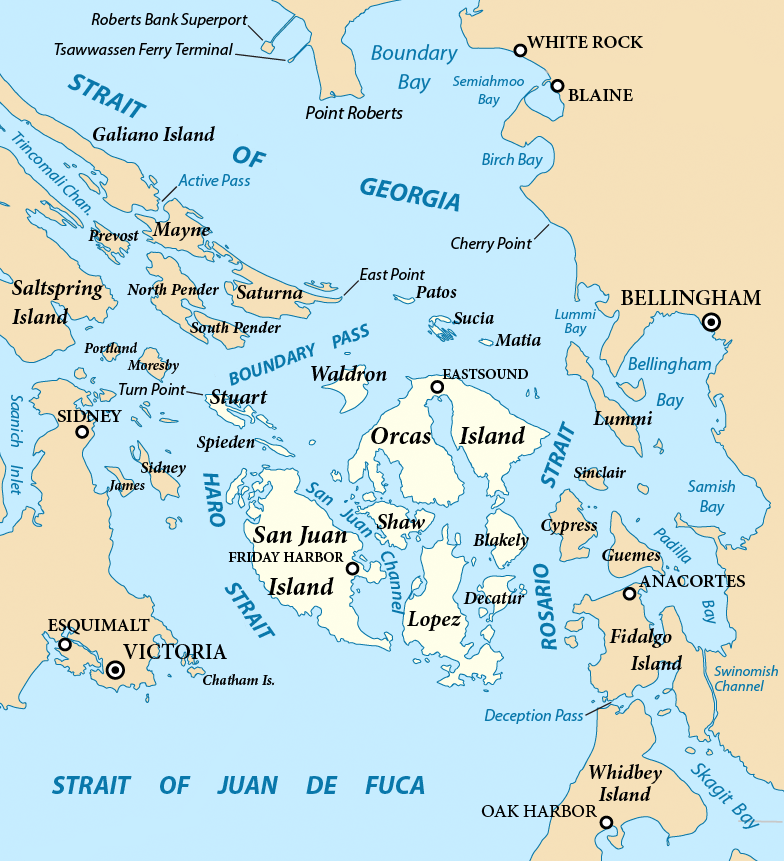
English: Map of the San Juan Islands (highlighted) and surrounding region. Created with ArcExplorer and Adobe Illustrator. Based on on GeoBase and The National Map data. Map projection: Washington State Plane North (State Plane Coordinate System). |
| Date | |
| Source | File:San Juan Islands map.png |
| Author | Pfly |
Licensing[edit]
This file is licensed under the Creative Commons Attribution-Share Alike 3.0 Unported license.
- You are free:
- to share – to copy, distribute and transmit the work
- to remix – to adapt the work
- Under the following conditions:
- attribution – You must give appropriate credit, provide a link to the license, and indicate if changes were made. You may do so in any reasonable manner, but not in any way that suggests the licensor endorses you or your use.
- share alike – If you remix, transform, or build upon the material, you must distribute your contributions under the same or compatible license as the original.
File history
Click on a date/time to view the file as it appeared at that time.
| Date/Time | Thumbnail | Dimensions | User | Comment | |
|---|---|---|---|---|---|
| current | 04:56, 5 July 2021 | | 784 × 861 (541 KB) | Tceditwiki (talk | contribs) | Uploaded a work by Pfly from File:San Juan Islands map.png with UploadWizard |
You cannot overwrite this file.
File usage on Commons
The following page uses this file: