File:San Rafael California Canal Area aerial view (cropped).jpg
跳转到导航
跳转到搜索

本预览的尺寸:800 × 378像素。 其他分辨率:320 × 151像素 | 640 × 302像素 | 1,496 × 706像素。
原始文件 (1,496 × 706像素,文件大小:811 KB,MIME类型:image/jpeg)
说明
说明
添加一行文字以描述该文件所表现的内容
| 描述 |
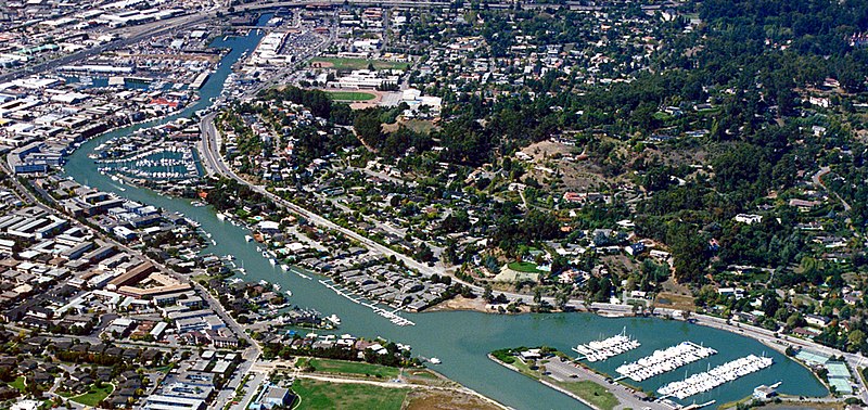
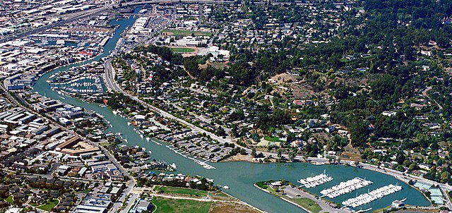
English: Aerial view of the Canal Area in San Rafael, California, USA. The area is situated along the western side of San Francisco Bay in Marin County, California. Pickleweed Park is situated on the point of land at center bottom in the picture. View is to the west.
Coordinates: 37°58′11.81″N 122°29′58.78″W / 37.9699472°N 122.4996611°W |
|||
| 图中地点 | San Rafael, California, USA | |||
| 日期 | not specified or unknown | |||
| 来源 |
U.S. Army Corps of Engineers Digital Visual Library Image page Image description page Digital Visual Library home page |
|||
| 作者 | Robert Campbell, U.S. Army Corps of Engineers | |||
| 授权 (二次使用本文件) |
|
|||
| 其他版本 |

.jpg¶ms=37_58_11.81_N_122_29_58.78_W_type:city)
文件历史
点击某个日期/时间查看对应时刻的文件。
| 日期/时间 | 缩略图 | 大小 | 用户 | 备注 | |
|---|---|---|---|---|---|
| 当前 | 2021年10月19日 (二) 01:43 | | 1,496 × 706(811 KB) | Cristiano Tomás(留言 | 贡献) | File:San Rafael California Canal Area aerial view.jpg cropped < 1 % horizontally, 29 % vertically using CropTool with precise mode. |
您不可以覆盖此文件。
文件用途
全域文件用途
以下其他wiki使用此文件:
- en.wikipedia.org上的用途
- eo.wikipedia.org上的用途
- zh.wikipedia.org上的用途
.jpg&oldid=652151249)