File:Sand Kriegerdenkmal (01).png
Jump to navigation
Jump to search
Size of this preview: 716 × 599 pixels. Other resolutions: 287 × 240 pixels | 574 × 480 pixels | 918 × 768 pixels | 1,223 × 1,024 pixels | 2,007 × 1,680 pixels.
Original file (2,007 × 1,680 pixels, file size: 5.02 MB, MIME type: image/png)
Captions
Captions
Add a one-line explanation of what this file represents
Summary[edit]
.png&action=edit§ion=1)
| Description |
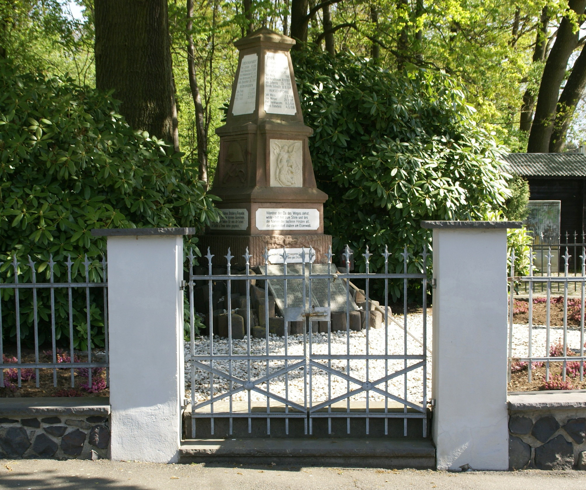
English: War memorial in Sand at the corner of Oberpleiser Straße and Pützstücker Straße in memory of the soldiers from several villages of this region who have been killed in the world wars 1914-1918 and 1939-1945
Deutsch: Kriegerdenkmal in Sand, Ecke Oberpleiser Straße und Pützstücker Straße, zur Erinnerung an die Soldaten aus mehreren Dörfern dieser Region, die während der Weltkriege 1914–1918 und 1939–1945 getötet wurden |
| Date | |
| Source | Own work |
| Author | Prof. emeritus Hans Schneider (Geyersberg) |
Licensing[edit]
.png&action=edit§ion=2)
I, the copyright holder of this work, hereby publish it under the following licenses:

|
Permission is granted to copy, distribute and/or modify this document under the terms of the GNU Free Documentation License, Version 1.2 or any later version published by the Free Software Foundation; with no Invariant Sections, no Front-Cover Texts, and no Back-Cover Texts. A copy of the license is included in the section entitled GNU Free Documentation License. |
This file is licensed under the Creative Commons Attribution 3.0 Unported license.
- You are free:
- to share – to copy, distribute and transmit the work
- to remix – to adapt the work
- Under the following conditions:
- attribution – You must give appropriate credit, provide a link to the license, and indicate if changes were made. You may do so in any reasonable manner, but not in any way that suggests the licensor endorses you or your use.
You may select the license of your choice.
| Camera location | | View this and other nearby images on: OpenStreetMap |
|---|
.png¶ms=050.712828_N_0007.304122_E_globe:Earth_type:camera__&language=en)
File history
Click on a date/time to view the file as it appeared at that time.
| Date/Time | Thumbnail | Dimensions | User | Comment | |
|---|---|---|---|---|---|
| current | 16:07, 18 April 2014 | | 2,007 × 1,680 (5.02 MB) | Geyersberg (talk | contribs) | {{Information |Description ={{en|1=War memorial in Sand at the corner of Oberpleiser Straße and Pützstücker Straße in memory of the soldiers from several villages of this region who have been killed in the world wars 1914-1918 and 1939-1945}} {{... |
You cannot overwrite this file.
File usage on Commons
The following page uses this file:
File usage on other wikis
The following other wikis use this file:
- Usage on de.wikipedia.org
.png&oldid=688295766)