File:SantaCatarina RM Carbonífera.svg
Jump to navigation
Jump to search

Size of this PNG preview of this SVG file: 800 × 586 pixels. Other resolutions: 320 × 234 pixels | 640 × 469 pixels | 1,024 × 750 pixels | 1,280 × 938 pixels | 2,560 × 1,876 pixels | 943 × 691 pixels.
Original file (SVG file, nominally 943 × 691 pixels, file size: 361 KB)
Captions
Captions
Add a one-line explanation of what this file represents
Summary[edit]
| Description |
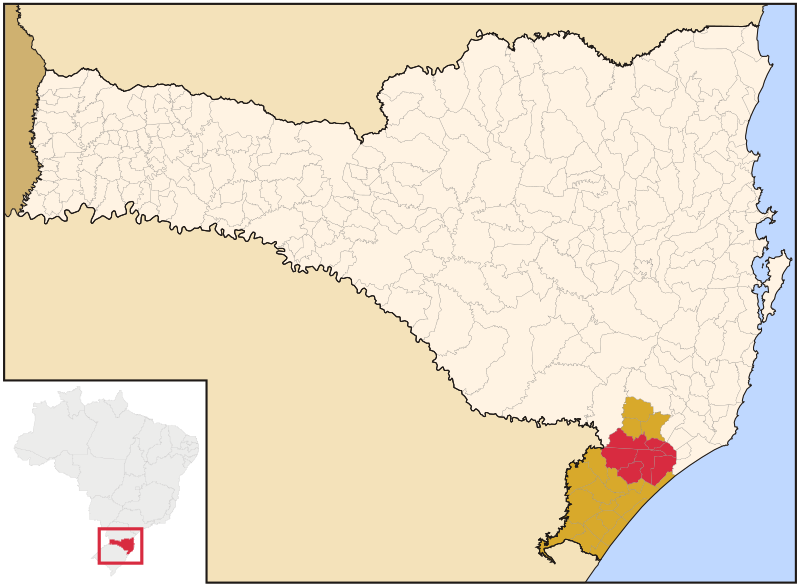
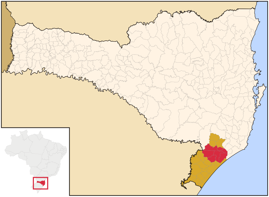
English: Mapa da Região Metropolitana Carbonífera, Santa Catarina, Brasil e sua área de expansão metropolitana.
Municípios
Área de expansão |
| Date | |
| Source |
This file was derived from: SantaCatarina MesoMicroMunicip.svg: |
| Author |
Original file: Raphael Lorenzeto de Abreu Derivate work: Gustavo Palma de Andrade Santos |
Licensing[edit]
This file is licensed under the Creative Commons Attribution 3.0 Unported license.
- You are free:
- to share – to copy, distribute and transmit the work
- to remix – to adapt the work
- Under the following conditions:
- attribution – You must give appropriate credit, provide a link to the license, and indicate if changes were made. You may do so in any reasonable manner, but not in any way that suggests the licensor endorses you or your use.
File history
Click on a date/time to view the file as it appeared at that time.
| Date/Time | Thumbnail | Dimensions | User | Comment | |
|---|---|---|---|---|---|
| current | 20:31, 26 January 2021 | | 943 × 691 (361 KB) | Palmandrade (talk | contribs) | Uploaded a work by Original file: Raphael Lorenzeto de Abreu Derivate work: Gustavo Palma de Andrade Santos from Derived from|SantaCatarina MesoMicroMunicip.svg|display=50 with UploadWizard |
You cannot overwrite this file.
File usage on Commons
There are no pages that use this file.
File usage on other wikis
The following other wikis use this file:
- Usage on es.wikipedia.org
- Usage on pt.wikipedia.org
- Criciúma
- Jacinto Machado
- Morro da Fumaça
- Sombrio
- Nova Veneza (Santa Catarina)
- Turvo (Santa Catarina)
- Araranguá
- Balneário Arroio do Silva
- Balneário Gaivota
- Cocal do Sul
- Ermo
- Forquilhinha
- Içara
- Lauro Müller (Santa Catarina)
- Maracajá
- Meleiro
- Morro Grande
- Passo de Torres
- Santa Rosa do Sul
- São João do Sul
- Siderópolis
- Timbé do Sul
- Treviso (Santa Catarina)
- Urussanga
- Praia Grande (Santa Catarina)
- Balneário Rincão
- Região Metropolitana Carbonífera
- Predefinição:Região Metropolitana Carbonífera
- Usuário:DAR7/Testes/Geografia de Santa Catarina/Criciúma