File:Saxony nol.png
Jump to navigation
Jump to search
No higher resolution available.
Saxony_nol.png (400 × 303 pixels, file size: 9 KB, MIME type: image/png)
Captions
Captions
Add a one-line explanation of what this file represents
Summary[edit]
| Description |
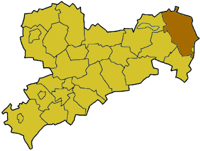
Deutsch: Karte Sachsens mit dem Niederschlesischen Oberlausitzkreis in den Grenzen von 1994 bis 1999
English: Map of Saxony with Niederschlesischer Oberlausitzkreis, borders in this form existed between 1994 and 1999 |
| Source | Modification of Image:Saxony template.png |
| Author | de:Benutzer:Baldhur, de:Benutzer:AHoerstemeier |
| Other versions |
 NOL in its borders since 1999 |
Licensing[edit]

|
Permission is granted to copy, distribute and/or modify this document under the terms of the GNU Free Documentation License, Version 1.2 or any later version published by the Free Software Foundation; with no Invariant Sections, no Front-Cover Texts, and no Back-Cover Texts. A copy of the license is included in the section entitled GNU Free Documentation License. |
| This file is licensed under the Creative Commons Attribution-Share Alike 3.0 Unported license. | ||
| ||
| This licensing tag was added to this file as part of the GFDL licensing update. |
File history
Click on a date/time to view the file as it appeared at that time.
| Date/Time | Thumbnail | Dimensions | User | Comment | |
|---|---|---|---|---|---|
| current | 11:05, 25 August 2007 | | 400 × 303 (9 KB) | 32X (talk | contribs) | slightly larger version |
| 12:18, 28 February 2006 |  | 280 × 212 (11 KB) | Tsca.bot (talk | contribs) | Karte Sachsens mit dem Niederschlesischer Oberlausitzkreis Karten sind selbsterstellt, z.T. durch triviales Ausmalen der Vorlagen aus [http://en.wikipedia.org/wiki/Wikipedia:WikiProject_German_districts/Maptemplates]. Daher allesamt GFDL. {{GFDL}} [[C |
You cannot overwrite this file.
File usage on Commons
The following page uses this file: