File:Schwelm Denkmäler Stadt südlich.JPG
Jump to navigation
Jump to search

Size of this preview: 668 × 599 pixels. Other resolutions: 268 × 240 pixels | 535 × 480 pixels | 856 × 768 pixels | 1,142 × 1,024 pixels | 2,195 × 1,969 pixels.
Original file (2,195 × 1,969 pixels, file size: 843 KB, MIME type: image/jpeg)
Captions
Captions
Add a one-line explanation of what this file represents
Summary
[edit]
| Description |
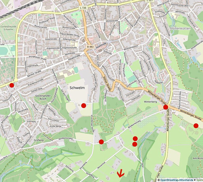
Deutsch: Lage von Bau- und Bodendenkmälern in Schwelm, Bereich äußere Stadt südlich. (Unten außerhalb ergänzen sich noch die Bodendenkmale Weuste, Vesterberg, Weberstal.) Kartenvorlage aus OpenStreetMap wurde um Markierungen (rot) ergänzt. |
| Date | |
| Source | https://www.openstreetmap.org/ |
| Author | © OpenStreetMap-Mitwirkende |
Licensing
[edit]
This file is licensed under the Creative Commons Attribution-Share Alike 4.0 International license.
- You are free:
- to share – to copy, distribute and transmit the work
- to remix – to adapt the work
- Under the following conditions:
- attribution – You must give appropriate credit, provide a link to the license, and indicate if changes were made. You may do so in any reasonable manner, but not in any way that suggests the licensor endorses you or your use.
- share alike – If you remix, transform, or build upon the material, you must distribute your contributions under the same or compatible license as the original.
File history
Click on a date/time to view the file as it appeared at that time.
| Date/Time | Thumbnail | Dimensions | User | Comment | |
|---|---|---|---|---|---|
| current | 09:06, 16 December 2020 | | 2,195 × 1,969 (843 KB) | Hannoverscher (talk | contribs) | Inhalt aktualisiert |
| 18:47, 29 March 2019 |  | 2,195 × 1,969 (829 KB) | Hannoverscher (talk | contribs) | {{Information |description ={{de|1=Lage von Bau- und Bodendenkmälern in Schwelm, Bereich äußere Stadt südlich. (Unten außerhalb ergänzen sich noch die Bodendenkmale Weuste, Vesterberg, Weberstal.) Kartenvorlage aus OpenStreetMap wurde um Markierungen (rot) ergänzt.}} |date =2019-03-29 |source =https://www.openstreetmap.org/ |author =© OpenStreetMap-Mitwirkende }} Category:OpenStreetMap maps |
You cannot overwrite this file.
File usage on Commons
The following page uses this file:
File usage on other wikis
The following other wikis use this file:
- Usage on de.wikipedia.org