File:Scotia Sea NOAA.jpg
Jump to navigation
Jump to search

Size of this preview: 800 × 406 pixels. Other resolutions: 320 × 162 pixels | 640 × 325 pixels | 1,024 × 520 pixels | 1,280 × 650 pixels | 3,180 × 1,614 pixels.
Original file (3,180 × 1,614 pixels, file size: 557 KB, MIME type: image/jpeg)
Captions
Captions
Add a one-line explanation of what this file represents
Summary
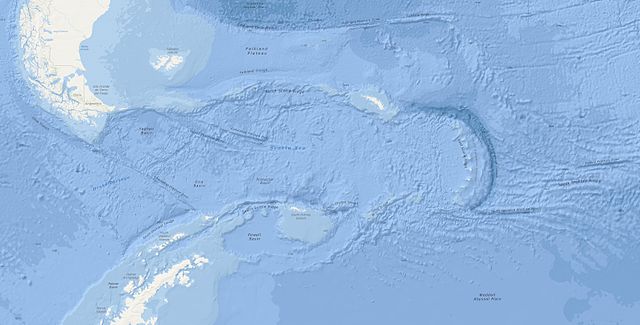
[edit]| Description | Bathymetric map of the Scotia Sea. |
| Date | (UTC) |
| Source | NOAA Digital Atlas |
| Author | Uploaded by Fama Clamosa (talk) 13:56, 13 July 2015 (UTC) |
| Permission (Reusing this file) |
Public Domain |
| Other versions |
|


Licensing
[edit]
This image is in the public domain because it contains materials that originally came from the U.S. National Oceanic and Atmospheric Administration, taken or made as part of an employee's official duties.
|
File history
Click on a date/time to view the file as it appeared at that time.
| Date/Time | Thumbnail | Dimensions | User | Comment | |
|---|---|---|---|---|---|
| current | 13:56, 13 July 2015 | | 3,180 × 1,614 (557 KB) | Fama Clamosa (talk | contribs) | {{Information |Description=Map of the w:Scotia Sea. |Source=[http://www.ncddc.noaa.gov/website/google_maps/OE/mapsOE.htm NOAA Digital Atlas] |Date=~~~~~ |Author=Uploaded by ~~~~ |Permission=Public Domain |other_versions= }} Category:Scotia Sea... |
You cannot overwrite this file.
File usage on Commons
The following 2 pages use this file:
File usage on other wikis
The following other wikis use this file:
- Usage on az.wikipedia.org
- Usage on bg.wikipedia.org
- Usage on de.wikipedia.org
- Usage on en.wikipedia.org
- Usage on es.wikipedia.org
- Usage on eu.wikipedia.org
- Usage on fa.wikipedia.org
- Usage on hi.wikipedia.org
- Usage on hr.wikipedia.org
- Usage on it.wikipedia.org
- Usage on it.wikibooks.org
- Usage on it.wikiversity.org
- Usage on nl.wikipedia.org
- Usage on ru.wikipedia.org
- Usage on uk.wikipedia.org
- Usage on www.wikidata.org
- Usage on zh.wikipedia.org