File:Sečská přehrada, CZ140322-086.jpg
Jump to navigation
Jump to search

Size of this preview: 800 × 567 pixels. Other resolutions: 320 × 227 pixels | 640 × 454 pixels | 1,024 × 726 pixels | 1,280 × 908 pixels | 2,560 × 1,816 pixels | 4,289 × 3,042 pixels.
Original file (4,289 × 3,042 pixels, file size: 4.02 MB, MIME type: image/jpeg)
Captions
Captions
Add a one-line explanation of what this file represents
Summary
[edit]
| Description |
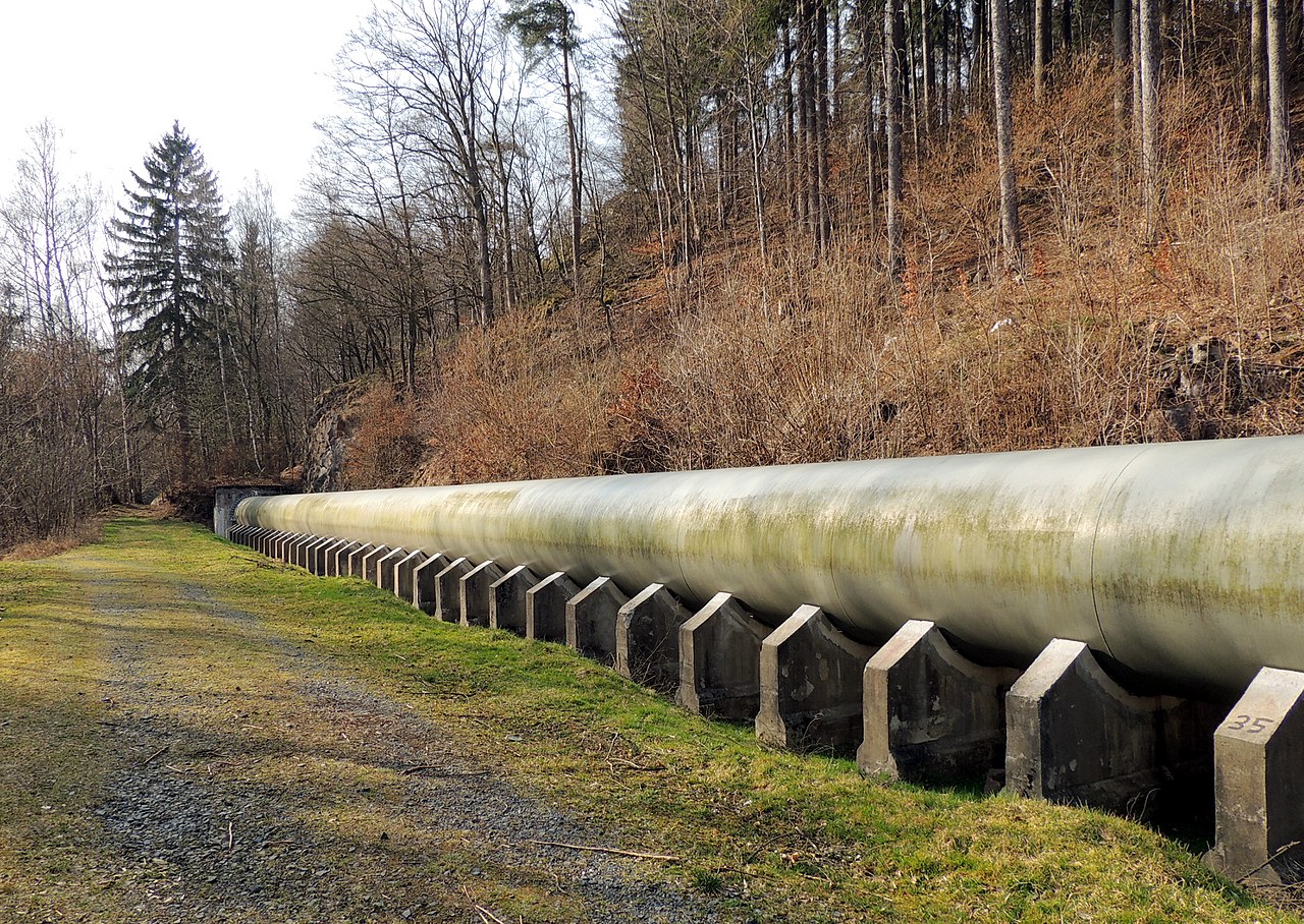
English: Sečská dam. Piping of the water supply to the power plant, on the left bank of the river Chrudimka. The power station is 1.2 km away from the dam. The original pipeline made in 1941 to 1943 was made of wooden veneer and was lined with steel hoops. In 2010 was to replaced by pipelines from steel (photo). Photo location: Czech Republic, Pardubice Region, town Seč, Seč Dam, "Kameničská" highlands.
Čeština: Sečská přehrada. Potrubí přivaděče vody do elektrárny, na levém břehu řeky Chrudimky. Elektrárna leží ve vzdálenosti 1,2 km od přehrady. Původní potrubí vyrobené v letech 1941 až 1943 bylo z dřevěné dýhy a obepnuté ocelovými obručemi. V roce 2010 bylo nahrazeno potrubím z ocele (foto). Foto lokace: Česko, Pardubický kraj, město Seč, Sečská přehrada (275°), Kameničská vrchovina. |
| Date | |
| Source | Own work |
| Author | Josef Kreuz (PEPan) |
| Camera location | | View this and other nearby images on: OpenStreetMap |
|---|
Externí odkazy
[edit]
- Povodí Labe, státní podnik archive copy at the Wayback Machine
- Sečská přehrada – faktografická data
- Historie vodního stavitelství na řece Chrudimce – publikace
Licensing
[edit]
I, the copyright holder of this work, hereby publish it under the following license:
This file is licensed under the Creative Commons Attribution-Share Alike 4.0 International license.
- You are free:
- to share – to copy, distribute and transmit the work
- to remix – to adapt the work
- Under the following conditions:
- attribution – You must give appropriate credit, provide a link to the license, and indicate if changes were made. You may do so in any reasonable manner, but not in any way that suggests the licensor endorses you or your use.
- share alike – If you remix, transform, or build upon the material, you must distribute your contributions under the same or compatible license as the original.
File history
Click on a date/time to view the file as it appeared at that time.
| Date/Time | Thumbnail | Dimensions | User | Comment | |
|---|---|---|---|---|---|
| current | 14:57, 10 November 2017 | | 4,289 × 3,042 (4.02 MB) | PEPan (talk | contribs) | User created page with UploadWizard |
You cannot overwrite this file.
File usage on Commons
There are no pages that use this file.
File usage on other wikis
The following other wikis use this file:
- Usage on cs.wikipedia.org