File:Seattle Link and Sounder Services.png
Jump to navigation
Jump to search

Size of this preview: 332 × 599 pixels. Other resolutions: 133 × 240 pixels | 266 × 480 pixels | 425 × 768 pixels | 567 × 1,024 pixels | 1,134 × 2,048 pixels | 7,505 × 13,547 pixels.
Original file (7,505 × 13,547 pixels, file size: 2.25 MB, MIME type: image/png)
Captions
Captions
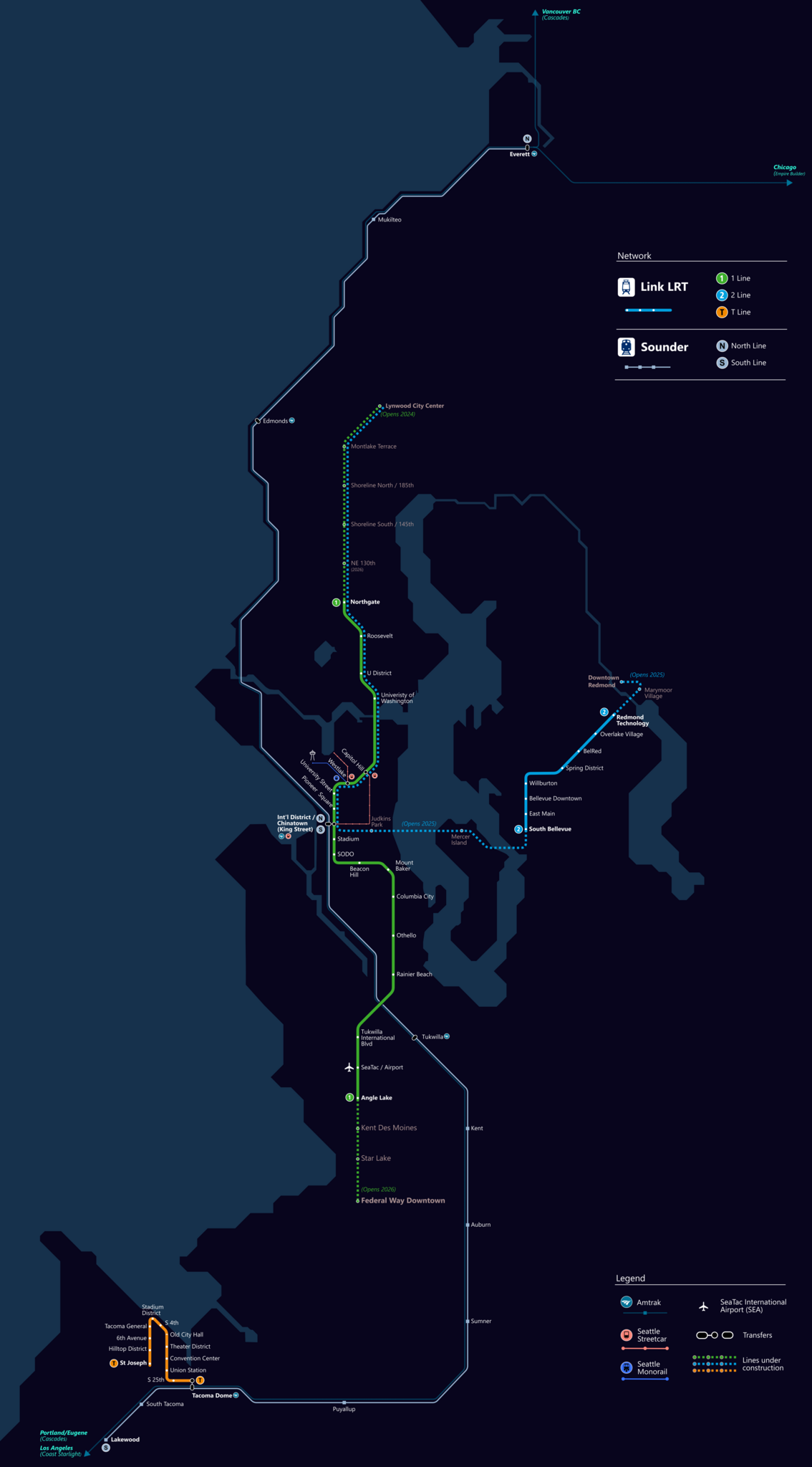
Sound Transit Rail Services as of April 27th, 2024
Summary
[edit]
| Description |
English: A geographically referenced map of lines of the Link light rail, including parts under construction (dashed in map), overlayed on a basemap includes Sounder commuter rail lines, Amtrak, water areas, area landmarks. Shapefiles from the United States Census Bureau, the U.S. Geological Survey (USGS) Gap Analysis Project (GAP), Sound Transit, and OpenStreetMap (© OpenStreetMap contributors), converted Inkscape (Mercator projection). |
| Date | |
| Source | Own work |
| Author | X24mak |
Licensing
[edit]
I, the copyright holder of this work, hereby publish it under the following license:
This file is licensed under the Creative Commons Attribution 4.0 International license.
- You are free:
- to share – to copy, distribute and transmit the work
- to remix – to adapt the work
- Under the following conditions:
- attribution – You must give appropriate credit, provide a link to the license, and indicate if changes were made. You may do so in any reasonable manner, but not in any way that suggests the licensor endorses you or your use.
File history
Click on a date/time to view the file as it appeared at that time.
| Date/Time | Thumbnail | Dimensions | User | Comment | |
|---|---|---|---|---|---|
| current | 00:03, 12 April 2024 | | 7,505 × 13,547 (2.25 MB) | X24mak (talk | contribs) | Uploaded own work with UploadWizard |
You cannot overwrite this file.
File usage on Commons
There are no pages that use this file.