File:Segnavia sopra il rifugio Bolettone.jpg
Jump to navigation
Jump to search

Size of this preview: 546 × 599 pixels. Other resolutions: 219 × 240 pixels | 437 × 480 pixels | 700 × 768 pixels | 933 × 1,024 pixels | 2,210 × 2,426 pixels.
Original file (2,210 × 2,426 pixels, file size: 1.2 MB, MIME type: image/jpeg)
Captions
Captions
Add a one-line explanation of what this file represents
Summary[edit]
| Description |
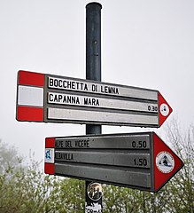
Italiano: Segnavia sopra il rifugio Bolettone, lungo la Dorsale del Triangolo Lariano per cresta, sul confine tra i comuni di Albavilla e Faggeto Lario.
Indicazioni perː - Bocchetta di Lemna, Capanna Mara - Alpe del Vicerè, Albavilla |
| Date | |
| Source | Own work |
| Author | Kaitu |
| Camera location | | View this and other nearby images on: OpenStreetMap |
|---|
|
Segnavia sopra il rifugio Bolettone.jpg has an entry on OpenStreetMap (show). |
Licensing[edit]
I, the copyright holder of this work, hereby publish it under the following license:
This file is licensed under the Creative Commons Attribution-Share Alike 4.0 International license.
- You are free:
- to share – to copy, distribute and transmit the work
- to remix – to adapt the work
- Under the following conditions:
- attribution – You must give appropriate credit, provide a link to the license, and indicate if changes were made. You may do so in any reasonable manner, but not in any way that suggests the licensor endorses you or your use.
- share alike – If you remix, transform, or build upon the material, you must distribute your contributions under the same or compatible license as the original.
File history
Click on a date/time to view the file as it appeared at that time.
| Date/Time | Thumbnail | Dimensions | User | Comment | |
|---|---|---|---|---|---|
| current | 09:00, 17 June 2022 | | 2,210 × 2,426 (1.2 MB) | Kaitu (talk | contribs) | Uploaded own work with UploadWizard |
You cannot overwrite this file.
File usage on Commons
The following page uses this file: