File:Serbia and Montenegro.svg
跳转到导航
跳转到搜索

此SVG文件的PNG预览的大小:450 × 456像素。 其他分辨率:237 × 240像素 | 474 × 480像素 | 758 × 768像素 | 1,011 × 1,024像素 | 2,021 × 2,048像素。
原始文件 (SVG文件,尺寸为450 × 456像素,文件大小:586 KB)
说明
说明
添加一行文字以描述该文件所表现的内容
| 描述 |
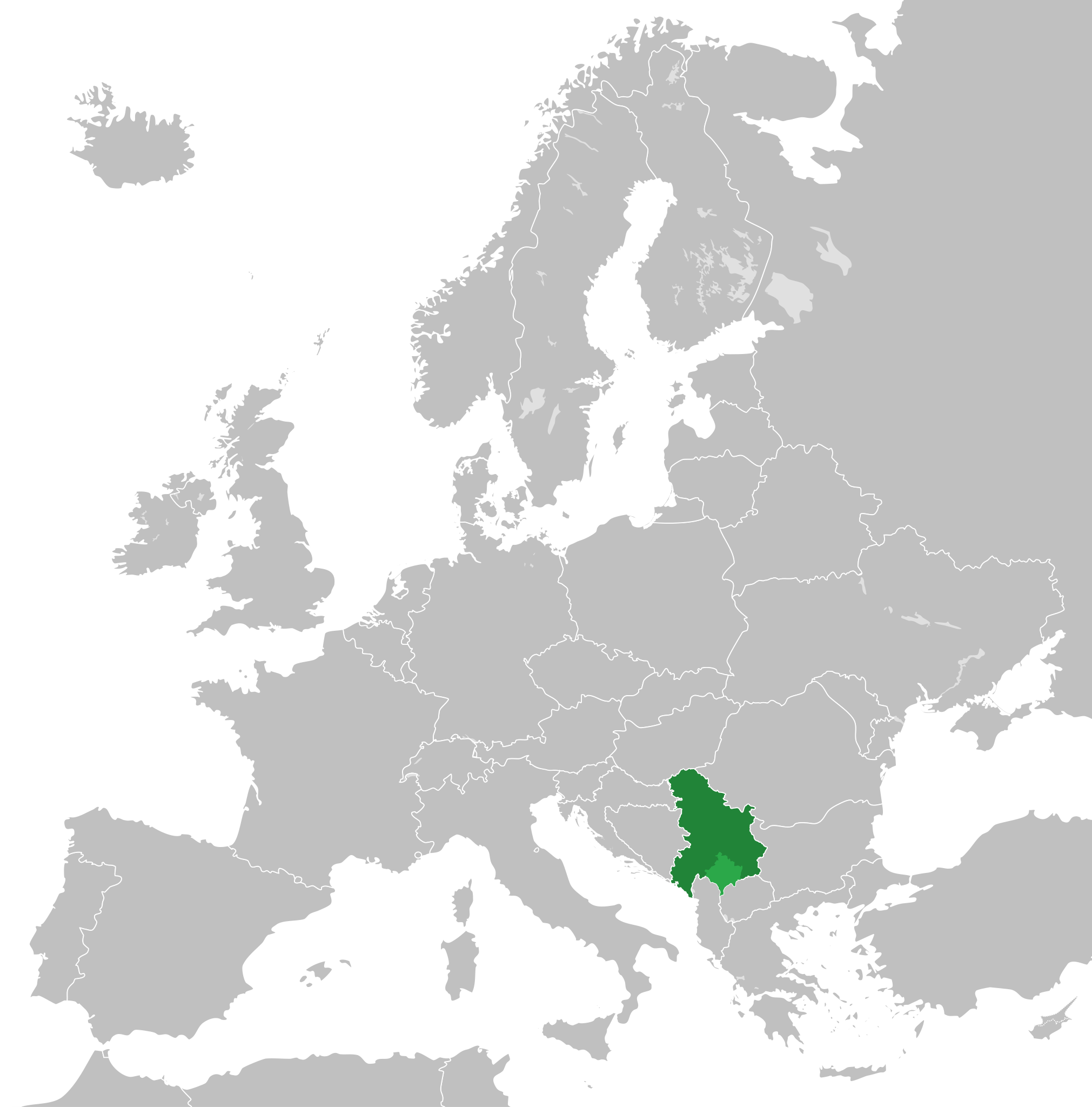
English: Map of the Federal Republic of Yugoslavia (1992-2003) and the State Union of Serbia and Montenegro (2003-2006).
Note: Following the adoption of Resolution 1244 on 10 June 1999, Kosovo was placed under a UN Interim Administration – de facto separating it from the rest of Yugoslavia. |
| 日期 | |
| 来源 | Own work, based upon File:Blank map of Europe.svg |
| 作者 | |
| 授权 (二次使用本文件) |
本文件采用知识共享署名-相同方式共享 3.0 未本地化版本许可协议授权。
|
文件历史
点击某个日期/时间查看对应时刻的文件。
| 日期/时间 | 缩略图 | 大小 | 用户 | 备注 | |
|---|---|---|---|---|---|
| 当前 | 2020年8月31日 (一) 01:48 | | 450 × 456(586 KB) | Savasampion(留言 | 贡献) | Kosovo fixed |
| 2019年4月27日 (六) 18:31 |  | 450 × 456(586 KB) | Illegitimate Barrister(留言 | 贡献) | cleanup nodes | |
| 2018年7月5日 (四) 05:05 |  | 450 × 456(587 KB) | TRAJAN 117(留言 | 贡献) | +++ | |
| 2015年5月2日 (六) 22:08 |  | 450 × 456(584 KB) | TRAJAN 117(留言 | 贡献) | +++ | |
| 2013年8月17日 (六) 13:15 |  | 680 × 520(598 KB) | TRAJAN 117(留言 | 贡献) | Adjustment | |
| 2011年12月13日 (二) 22:43 |  | 680 × 520(654 KB) | TRAJAN 117(留言 | 贡献) | {{Information |Description ={{en|1=Map of Serbia and Montenegro, circa 2002.}} |Source =Own work, based upon [http://commons.wikimedia.org/wiki/File:Blank_map_of_Europe.svg] |Author =25px '''[[ |
您不可以覆盖此文件。
文件用途
以下23个页面使用本文件:
- User:J budissin/Uploads/BiH/2018 July 1-10
- User:J budissin/Uploads/BiH/2019 April 21-30
- Commons:Graphic Lab/Illustration workshop/Archive/2013
- Category:1994 in Yugoslavia
- Category:1995 in Yugoslavia
- Category:1996 in Yugoslavia
- Category:1997 in Yugoslavia
- Category:1998 in Yugoslavia
- Category:1999 in Yugoslavia
- Category:2002 in Yugoslavia
- Category:2003 in Serbia and Montenegro
- Category:2003 in Yugoslavia
- Category:2004 in Serbia and Montenegro
- Category:2005 in Serbia and Montenegro
- Category:2006 in Serbia and Montenegro
- Category:Culture of Serbia and Montenegro
- Category:Events in Serbia and Montenegro
- Category:Federal Republic of Yugoslavia
- Category:Maps of Serbia and Montenegro
- Category:Serbia and Montenegro
- Category:Serbia and Montenegro by year
- Category:Sports events in Serbia and Montenegro
- Category:Tennis players from Serbia and Montenegro
全域文件用途
以下其他wiki使用此文件:
- af.wikipedia.org上的用途
- ar.wikipedia.org上的用途
- arz.wikipedia.org上的用途
- ast.wikipedia.org上的用途
- azb.wikipedia.org上的用途
- az.wikipedia.org上的用途
- be-tarask.wikipedia.org上的用途
- bg.wikipedia.org上的用途
- bn.wikipedia.org上的用途
- ca.wikipedia.org上的用途
- cs.wikipedia.org上的用途
- de.wikipedia.org上的用途
- en.wikipedia.org上的用途
- en.wikinews.org上的用途
- eo.wikipedia.org上的用途
- es.wikipedia.org上的用途
- fa.wikipedia.org上的用途
- fi.wikipedia.org上的用途
- fr.wikipedia.org上的用途
- fr.wikinews.org上的用途
- ga.wikipedia.org上的用途
- gl.wikipedia.org上的用途
- he.wikipedia.org上的用途
- hr.wikipedia.org上的用途
- hy.wikipedia.org上的用途
- ia.wikipedia.org上的用途
- id.wikipedia.org上的用途
- incubator.wikimedia.org上的用途
- it.wikipedia.org上的用途
- ja.wikipedia.org上的用途
- kk.wikipedia.org上的用途
- ko.wikipedia.org上的用途
- lb.wikipedia.org上的用途
- li.wikipedia.org上的用途
查看此文件的更多全域用途。