File:SgMien @CanTy-HaGiang.jpg
Jump to navigation
Jump to search

Size of this preview: 799 × 600 pixels. Other resolutions: 320 × 240 pixels | 640 × 480 pixels | 1,023 × 768 pixels | 1,280 × 961 pixels | 1,451 × 1,089 pixels.
Original file (1,451 × 1,089 pixels, file size: 198 KB, MIME type: image/jpeg)
Captions
Captions
Add a one-line explanation of what this file represents
Summary
[edit]
| Description |
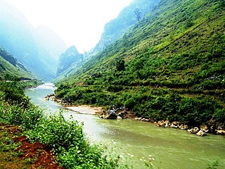
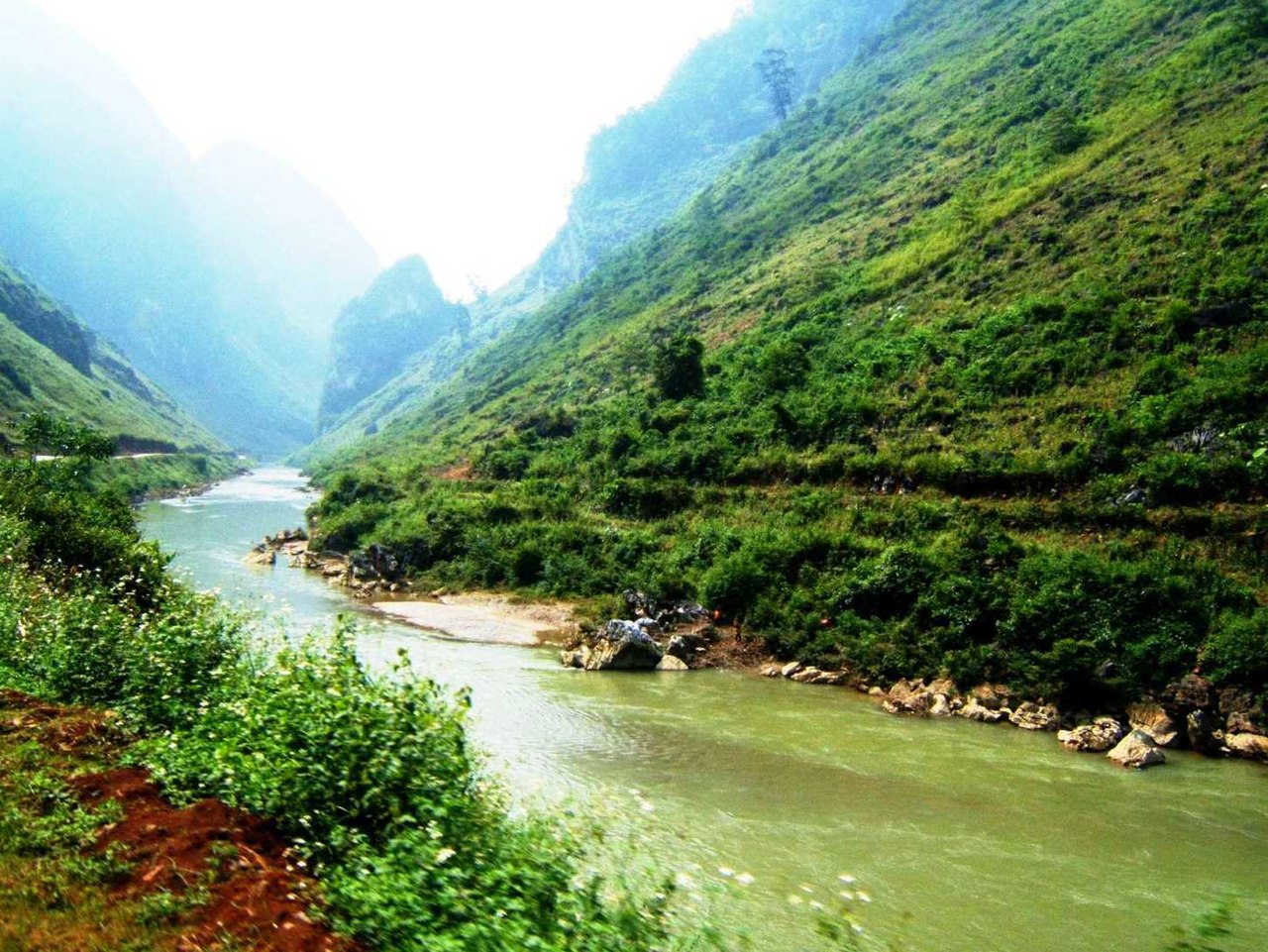
Tiếng Việt: Sông Miện, đoạn ở bắc xã Cán Tỷ Quản Bạ, Hà Giang. Quốc lộ 4C mở dọc bờ sông. English: Mien River, the section in Can Ty commune, Quản Bạ District, Ha Giang province, Vietnam. Road 4C is along the river bank. |
| Date | 12 March 2017 (original upload date) |
| Source | Transferred from vi.wikipedia to Commons. |
| Author | BacLuong at Vietnamese Wikipedia |
| Camera location | | View this and other nearby images on: OpenStreetMap |
|---|
Licensing
[edit]
| |
This work has been released into the public domain by its author, BacLuong, at the English Wikipedia project. This applies worldwide. In case this is not legally possible: |
Original upload log
[edit]
The original description page was here. All following user names refer to vi.wikipedia.
| Date/Time | Dimensions | User | Comment |
|---|---|---|---|
| 2017-03-12 14:05 | 1451×1089× (202919 bytes) | BacLuong | Mien River, the section in Can Ty commune, [[Quản Bạ District]], [[Ha Giang province]], Vietnam. |
File history
Click on a date/time to view the file as it appeared at that time.
| Date/Time | Thumbnail | Dimensions | User | Comment | |
|---|---|---|---|---|---|
| current | 10:34, 1 January 2019 | | 1,451 × 1,089 (198 KB) | BacLuong (talk | contribs) | Transferred from vi.wikipedia via #commonshelper |
You cannot overwrite this file.
File usage on Commons
There are no pages that use this file.
File usage on other wikis
The following other wikis use this file:
- Usage on vi.wikipedia.org