File:Shoreham Airport OSM.png
Jump to navigation
Jump to search

Size of this preview: 723 × 599 pixels. Other resolutions: 290 × 240 pixels | 579 × 480 pixels | 927 × 768 pixels | 1,058 × 877 pixels.
Original file (1,058 × 877 pixels, file size: 227 KB, MIME type: image/png)
Captions
Captions
Add a one-line explanation of what this file represents
Summary
[edit]
| Description |
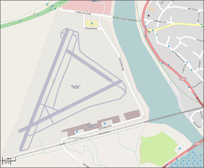
English: Map of the Shoreham Airport (UK) Deutsch: Karte des Flughafens Shoreham Français : Carte de l'aéroport de Shoreham Alemannisch: Charte vom Flughafe vo Shoreham Italiano: Mappa di Shoreham Airport |
| Date | |
| Source | openstreetmap.org |
| Creator |
OpenStreetMap contributors |
| Permission (Reusing this file) |
OpenStreetMap data and maps are licensed under the Creative Commons Attribution-ShareAlike 2.0 license (CC-BY-SA 2.0). This file is licensed under the Creative Commons Attribution-Share Alike 2.0 Generic license.
|
| Georeferencing | If inappropriate please set warp_status = skip to hide. |
File history
Click on a date/time to view the file as it appeared at that time.
| Date/Time | Thumbnail | Dimensions | User | Comment | |
|---|---|---|---|---|---|
| current | 09:54, 4 November 2011 | | 1,058 × 877 (227 KB) | Eruedin (talk | contribs) |
You cannot overwrite this file.
File usage on Commons
There are no pages that use this file.
File usage on other wikis
The following other wikis use this file:
- Usage on de.wikipedia.org
- Usage on en.wikipedia.org
- Usage on fr.wikipedia.org
- Usage on pl.wikipedia.org
- Usage on pms.wikipedia.org
- Usage on ru.wikipedia.org