File:Sino-Indian Geography.png
跳转到导航
跳转到搜索
本预览的尺寸:800 × 565像素。 其他分辨率:320 × 226像素 | 640 × 452像素 | 918 × 648像素。
原始文件 (918 × 648像素,文件大小:1.36 MB,MIME类型:image/png)
说明
说明
添加一行文字以描述该文件所表现的内容
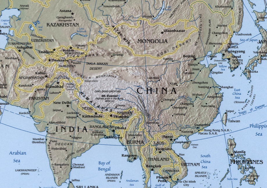
A map showing the geography of the Sino-Indian region.
A physical map with relief showing shading. Scale 1:48,000,000 ; Azimuthal equal-area projection (W 50--W 1650/N 880--S 180).
Cropped from a larger map showing Asia - which may be found on the Library of Congress website (the source image) or alternatively on the CIA World Factbook.
Image created and published by the Central Intelligence Agency of the United States of America in 2004.
Note
[编辑]
The land border between the China and India over Arunachal Pradesh / South Tibet reflects actual control, without dotted line showing claims
|
|
 |
文件历史
点击某个日期/时间查看对应时刻的文件。
| 日期/时间 | 缩略图 | 大小 | 用户 | 备注 | |
|---|---|---|---|---|---|
| 当前 | 2004年11月22日 (一) 19:32 | | 918 × 648(1.36 MB) | OldakQuill(留言 | 贡献) | |
| 2004年11月22日 (一) 09:38 |  | 354 × 350(98 KB) | OldakQuill(留言 | 贡献) | A map showing the geography of the Sino-Indian region. {{pd}} |
您不可以覆盖此文件。
文件用途
以下2个页面使用本文件:
全域文件用途
以下其他wiki使用此文件:
- ar.wikipedia.org上的用途
- az.wikipedia.org上的用途
- bn.wikipedia.org上的用途
- de.wikipedia.org上的用途
- en.wikipedia.org上的用途
- fa.wikipedia.org上的用途
- fr.wikipedia.org上的用途
- ha.wikipedia.org上的用途
- hi.wikipedia.org上的用途
- hy.wikipedia.org上的用途
- id.wikipedia.org上的用途
- mn.wikipedia.org上的用途
- ms.wikipedia.org上的用途
- nl.wikipedia.org上的用途
- pnb.wikipedia.org上的用途
- ru.wikipedia.org上的用途
- sr.wikipedia.org上的用途
- tr.wikipedia.org上的用途
- uk.wikipedia.org上的用途
- ur.wikipedia.org上的用途
- uz.wikipedia.org上的用途
- www.wikidata.org上的用途
- zh.wikipedia.org上的用途