Category:Maps of Asia
Jump to navigation
Jump to search
Temperate regions: North America · South America · Africa · Europe · Asia · Oceania – Polar regions: Antarctica · Arctic – Other regions: Afro-Eurasia · Eurasia
overview of the cartography of Asia | |||||
| Upload media | |||||
| Instance of | |||||
|---|---|---|---|---|---|
| Main subject | |||||
| |||||
- Maps are also available as part of the
 Wikimedia Atlas of the World project in the Atlas of Asia.

Subcategories
This category has the following 63 subcategories, out of 63 total.
!
*
+
- Global maps centered 70E (2 F)
- Global maps centered 80E (2 F)
A
- ABU Song Festivals maps (12 F)
B
C
- CIA World Factbook maps of Asia (26 F)
D
E
- ECHO Situation Maps of Asia (empty)
- Emesene (1 F)
F
G
- Geomorphological maps of Asia (18 F)
- Maps of the Gobi Desert (56 F)
H
I
L
M
- Maps of glaciers of Asia (2 F)
O
P
- Maps of Pamir Mountains (27 F)
R
S
- Sea level maps of Asia (15 F)
T
W
~
Media in category "Maps of Asia"
The following 200 files are in this category, out of 275 total.
(previous page) (next page)-
 0330takobo.jpg 319 × 377; 31 KB
-
 1687 жылғы итальяндық картадағы қазақтар.jpg 2,330 × 1,442; 956 KB
-
 1ContinentAsia.png 698 × 602; 68 KB
-
 2011 AFC Asian Cup qualification.PNG 487 × 447; 11 KB
-
 A buddhizmus elterjedése Ázsiában.png 1,100 × 837; 247 KB
-
 A789b20e156534f74032e838f1cc14e0 copia.jpg 3,315 × 2,545; 4.45 MB
-
 Abkhazia map-fr Inkscape.png 945 × 737; 898 KB
-
 Abkhazia map-fr librsvg.png 945 × 737; 785 KB
-
 Abkhazia map-fr rendersvg.png 945 × 737; 993 KB
-
 Alkoholersterwerbsalter in Asien.png 1,971 × 1,269; 256 KB
-
 Anambas.png 350 × 350; 15 KB
-
 Area erectus in asia3.jpg 249 × 314; 17 KB
-
 ASEAN with Plus 3 and Plus 6.png 4,206 × 4,202; 654 KB
-
 Aserbaidschan-Pos.png 330 × 302; 20 KB
-
 Asia 576.png 3,735 × 2,310; 19.27 MB
-
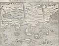
 Asia d Anville.png 2,926 × 2,800; 11.73 MB
-
 Asia in 1900.png 3,915 × 3,063; 4 MB
-
 Asia Map (with background).png 2,533 × 1,287; 7.27 MB
-
 Asia mrg 2019224.png 720 × 480; 451 KB
-
 Asia nah.png 1,500 × 1,200; 298 KB
-
 Asia Pornography Laws.jpg 881 × 720; 32 KB
-
 Asia satellite plane.jpg 800 × 464; 69 KB
-
 Asia subregions (1).png 370 × 304; 10 KB
-
 Asia subregions.png 403 × 298; 11 KB
-
 Asia terrain.jpg 1,002 × 960; 123 KB
-
 Asia y Oceanía españolas.png 863 × 628; 56 KB
-
 LGBT Flag map of Asia.png 2,000 × 1,560; 104 KB
-
 Asia-Recoloured.png 508 × 397; 9 KB
-
 Asia-UN.png 650 × 495; 103 KB
-
 Asian countries by population, 2018.png 3,099 × 2,406; 1.43 MB
-
 Asian Regions .jpg 2,000 × 1,414; 440 KB
-
 Asian Russia.png 2,996 × 1,722; 1.42 MB
-
 Asiaphysicalblank - Copy.jpg 4,354 × 3,087; 1.2 MB
-
 Asien-klein.png 507 × 665; 56 KB
-
 Asoka Kaart.png 959 × 577; 15 KB
-
 Asya Osmanı ve Asya Wasati.jpg 9,056 × 6,399; 10.04 MB
-
 Asyada Turk ve Tatar Hkumati.jpg 7,054 × 5,393; 6.42 MB
-
 Asóka terjeszkedése.png 3,996 × 2,404; 97 KB
-
 Azja.jpg 3,000 × 3,392; 2.85 MB
-

-
 B26056028G - Asia nova descriptio.jpg 6,340 × 5,067; 9.43 MB
-
 B26056030K - Asie.jpg 7,017 × 4,894; 10.24 MB
-
 B26056031A - Ancient Asia according to its general divisions.jpg 6,308 × 4,709; 8.01 MB
-

-
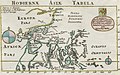
 B26056043D - Tabvla Asiae XI.jpg 6,205 × 4,842; 7.23 MB
-
 B26056045F - India orientalis et insula.jpg 6,507 × 5,000; 7.54 MB
-
 B26056046G - Suite de l'ocean oriental.jpg 5,175 × 5,041; 5.34 MB
-
 B26056047H - Les Indes oriental et leur archipel.jpg 5,537 × 4,340; 4.84 MB
-
 B26056074H - Asia secvnda pars terra in forma Pegasi.jpg 6,716 × 5,343; 9.89 MB
-
 B26056075I - Tabula orientalis regionis, Asia.jpg 6,317 × 4,980; 7.81 MB
-
 B26056101J - India orien.jpg 2,861 × 2,209; 1.57 MB
-
 B26056105C - Indes orientalles ou du Gange.jpg 4,424 × 3,334; 4.66 MB
-
 B26056117F - East Indies.jpg 6,864 × 4,285; 7.68 MB
-
 B26056160D - Hodiernæ Asia tabula.jpg 3,768 × 2,344; 1.98 MB
-
 B26056161E - Asiae nouita descr.jpg 2,585 × 1,951; 1.86 MB
-
 Bahrain map WV.png 2,500 × 2,752; 1,024 KB
-
 Bahrein-Pos.png 330 × 302; 20 KB
-
 Balhae map.png 1,024 × 1,024; 272 KB
-
 Bangladesh map.png 1,976 × 1,390; 145 KB
-
 Bates 141 locations.png 1,502 × 852; 571 KB
-
 BAV isolation sites 2007.jpg 480 × 405; 70 KB
-
 BeijingDistricts.png 2,127 × 2,054; 393 KB
-
 BlankAsia Map.png 1,971 × 1,269; 56 KB
-
 BlankMap-Far-East.png 534 × 459; 13 KB
-
 Buddhista kereskedelmi kapcsolatok I. század hu.png 2,383 × 1,048; 4.28 MB
-
 C-asia.png 140 × 95; 2 KB
-
 CACO Map.png 554 × 240; 9 KB
-
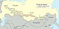 Carte Route de Siberie.jpg 1,000 × 500; 265 KB
-
 Central Asia.jpg 784 × 384; 99 KB
-
 China Pakistan Economic Corridor.jpg 3,000 × 2,395; 1.66 MB
-
 Containment of China.jpg 321 × 333; 32 KB
-
 Continental Asia Map mask.png 3,196 × 1,840; 23 KB
-
 Cut Yamal Peninsula.jpg 297 × 446; 205 KB
-
 D207- Planche VI - partie droite - liv3-ch09.png 2,362 × 3,390; 4.29 MB
-
 Dayuan-Lage.png 1,309 × 805; 258 KB
-
 Draco (constellation) Sea Map Somalia, Red Sea, India.png 2,294 × 1,620; 735 KB
-
 Earthquakes in China since 186 BC.png 716 × 480; 39 KB
-
 East Asia laea location map.jpg 336 × 599; 58 KB
-
 East Asia, Southeast Asia and the Pacific.png 2,044 × 2,048; 576 KB
-
 East Asian Cultural Sphere - Sinocentist.png 1,000 × 1,000; 291 KB
-
 EKVTA new.jpg 1,920 × 1,029; 329 KB
-
 EKVTA Org.jpg 640 × 640; 50 KB
-
 Eurasian borders.jpg 735 × 1,134; 557 KB
-
 Eurasian steppe belt.jpg 2,048 × 1,529; 1.62 MB
-
 EuroAsia Map.jpg 2,000 × 1,137; 2.06 MB
-
 Forest City Country Garden Presence Map.jpg 3,968 × 2,976; 1.93 MB
-
 Former Romance-speaking Asia.PNG 508 × 397; 13 KB
-
 Fwd locations.png 428 × 335; 13 KB
-
 Gastaldi Asia.png 8,793 × 7,631; 128.42 MB
-
 GENERAL-Massif 2May2010.jpg 2,618 × 2,730; 682 KB
-
 Geographic Boundaries of the First and Second Island Chains incl Straits.png 1,431 × 1,121; 169 KB
-
 Heilongjiang map.png 2,138 × 2,533; 1.08 MB
-
 Heilongjiang Province -map.png 800 × 919; 254 KB
-
 Henan prfc map vi.png 605 × 500; 48 KB
-
 Hengshan county.JPG 313 × 347; 23 KB
-
 History of Tokyo Bay,IImage Map.JPG 1,058 × 777; 183 KB
-
 HoA - Istanbul Process.png 1,400 × 625; 32 KB
-
 Horsethatleaps Map1 wikipedia.jpg 1,000 × 736; 387 KB
-
 Hyla tsinlingensis.png 453 × 333; 228 KB
-
 Hyla zhaopingensis 2.png 696 × 410; 537 KB
-
 Hyla zhaopingensis.png 377 × 260; 157 KB
-
 Icone monde indien pix001.png 45 × 50; 1 KB
-
 Imageasia.jpg 2,500 × 2,500; 1.81 MB
-
 Indes orientales2.JPG 731 × 643; 38 KB
-
 Index - Operational Navigation Chart - Europe-Asia-Africa.png 1,367 × 966; 424 KB
-
 India Andhra Pradesh location map 1.png 1,099 × 1,024; 287 KB
-
 India-Asia collision with no intraplate deformation.jpg 800 × 600; 231 KB
-
 Indies.PNG 1,427 × 660; 39 KB
-
 Indochina map.PNG 508 × 397; 11 KB
-
 Iran India Pakistan earthquake centre, Delhi.jpg 1,016 × 880; 659 KB
-
 Iran nuclear program map-es.png 800 × 595; 832 KB
-
 Iran Pakistan India map.png 926 × 659; 1.21 MB
-
 JaliMP.jpg 466 × 326; 108 KB
-
 Jesus’ Journey to Kashmir.jpg 504 × 392; 48 KB
-
 Jiaxing mcp.jpg 500 × 473; 13 KB
-
 Jinyubiaozhunfenqu.png 576 × 640; 380 KB
-
 Jonub-Iran.png 895 × 823; 22 KB
-
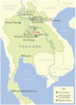 Joyce White Map.png 4,040 × 5,619; 1.04 MB
-
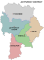 Joypurhat zila.png 250 × 339; 96 KB
-
 Karta CN SouthChinaSea-zh.png 350 × 350; 14 KB
-
 Karta CN SouthChinaSea.PNG 350 × 350; 13 KB
-
 Katar-Pos.png 330 × 302; 20 KB
-
 Kazakh Khanate map.png 1,600 × 933; 190 KB
-
 Khariirada dawladii salaajiqada.jpg 3,840 × 2,600; 2.16 MB
-
 Khiva1600.png 1,644 × 959; 50 KB
-
 Kleinasien Hethiter.JPG 749 × 353; 23 KB
-
 KokugunYochi1849 full.png 3,296 × 1,000; 4.52 MB
-
 Koreez.PNG 427 × 250; 17 KB
-
 Kuangtahsingspot.png 597 × 852; 166 KB
-

-
 Lakhimpurkheri.png 448 × 416; 53 KB
-
 Lalitpurdystrykt.png 448 × 416; 53 KB
-
 Languages of Bihar.gif 1,409 × 960; 364 KB
-
 Lead Photo For ประวัติศาสตร์ไทย0-6960814297199249.jpg 341 × 599; 68 KB
-
 Legal Status of Prostitution in Asia.png 800 × 635; 110 KB
-
 Leopard cat distribution 2022.jpg 1,011 × 710; 155 KB
-
 Lhasa and its mysteries.jpg 2,617 × 1,555; 656 KB
-
 Linghai Jixian.png 1,818 × 1,530; 4.16 MB
-
 Literal translation of country names.jpg 4,500 × 3,172; 1.49 MB
-
 Location Assam.PNG 799 × 573; 56 KB
-
 Location of Chaung-U in map.png 258 × 543; 106 KB
-
 Location-Asia-UNsubregions-Upscaled Version.png 1,054 × 824; 808 KB
-
 Location-Asia-UNsubregions.png 527 × 412; 19 KB
-
 LocationEastAsia (WikiProject East Asia Version).png 1,357 × 628; 30 KB
-
 LocationofBekistan.PNG 508 × 397; 13 KB
-
 Locations important to the Kandyan Naval Raid (1612-13).png 3,221 × 2,413; 416 KB
-
 Los 7 Dragones asiáticos.PNG 1,018 × 724; 206 KB
-
 Länder, in denen Nowruz gefeiert wird.png 554 × 420; 16 KB
-
 M175 haplogroup map, Asia.png 750 × 600; 9 KB
-
 Mahajana térkép.png 3,992 × 2,746; 110 KB
-
 MahayanaMap.gif 958 × 659; 21 KB
-
 Map Asia physical (continental).png 3,196 × 1,840; 13.24 MB
-
 Map Cheonan City District.png 602 × 568; 30 KB
-
 Map Highlighting ASEAN and Japan.svg 550 × 550; 2.38 MB
-
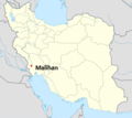 Map Malihan.png 250 × 223; 27 KB
-
 Map of Asia (Cropped).png 1,018 × 775; 126 KB
-
 Map of Asia (full, mute).png 3,710 × 1,888; 15.67 MB
-
 Map of Asia (mute).png 3,050 × 1,820; 12.43 MB
-
 Map of continental Asia (physical, cropped).png 3,196 × 1,608; 11.46 MB
-
 Map of mekong delta.jpg 557 × 882; 208 KB
-
 Map of oldest companies in Asia; February 2020.png 1,200 × 1,331; 283 KB
-
 Map of Sejong Special Autonomous City.png 824 × 1,221; 177 KB
-
 Map of Shilianghe.JPG 4,611 × 4,166; 8.08 MB
-
 Map of shunan city en.PNG 289 × 360; 9 KB
-
 Map of the Four Commanderies.png 1,821 × 2,200; 2.59 MB
-
 Map of Upper Paleolithic eyed needles.tif 1,771 × 1,181; 5.26 MB
-
 Map of Yamaguchi city en.PNG 430 × 345; 9 KB
-
 Map of Zhufan Village.JPG 2,170 × 2,315; 885 KB
-
 Map Turkickadai Newest 51st State.jpg 1,062 × 841; 352 KB
-
 Mapa Azji.png 600 × 428; 44 KB
-
 Mapa da ásia.png 601 × 388; 18 KB
-
 MapAsiacoords-svwp640.jpg 640 × 400; 9 KB
-
 MapAsiaGeonamesallCountries.jpg 1,800 × 1,200; 356 KB
-
 MapAsiaGeonamesallCountries640.jpg 640 × 400; 67 KB
-
 Maury Geography 115A Asia relief.jpg 2,495 × 2,071; 1.05 MB
-
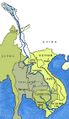 Mekong river location.jpg 328 × 568; 52 KB
-
 Microhyla eos distribution.png 2,008 × 1,590; 4.67 MB
-
 Migration route of Wusun in Western Han Dynasty.png 1,016 × 466; 1.05 MB
-
 Moyen-Orient.PNG 602 × 544; 11 KB
-
 Mural - mapa central - Asia.jpg 2,560 × 1,440; 1.55 MB
-
 Nei Mongol mcp.png 772 × 541; 27 KB
-
 Nei Mongol prfc map vi.png 772 × 541; 54 KB
-
 NetzentwuerfeGnomonisch.png 342 × 212; 213 KB
-
 NetzentwuerfeHotineObliqueMercator.png 343 × 209; 211 KB
-
 NetzentwuerfeLaengentreueAzimuthal.png 341 × 210; 20 KB
-
 NetzentwuerfeRobinson.png 341 × 210; 210 KB
-
 NetzentwuerfeSenkrechteUmgebung.png 211 × 209; 130 KB
-
 NetzentwuerfeSinusoidal.png 341 × 210; 210 KB
-
 NetzentwuerfeStereographisch.png 342 × 210; 211 KB
-
 NetzentwuerfeTransverseMercator.png 342 × 209; 16 KB
-
 Ningbo mcp.jpg 500 × 570; 19 KB
-
 Nixon Presidential Library & Museum (30608028660).jpg 2,736 × 1,824; 2.09 MB
-
 NixononCambodia.jpg 2,949 × 1,917; 1.1 MB
-
 North India Zonal Map.png 514 × 600; 169 KB
-
 North Korea map.gif 329 × 355; 21 KB
-

-
 NorthChina.png 2,039 × 2,290; 579 KB
-
 Northeast Asia map7845.png 387 × 180; 14 KB
-
 NorthEastChina.png 1,921 × 2,451; 960 KB
-
 NorthWestChina.png 2,495 × 1,609; 473 KB


.png)


.png)


_Sea_Map_Somalia,_Red_Sea,_India.png)


.png)

.png)


.png)


.png)
.png)
.png)
.png)


.jpg)


.jpg)


