File:Skagerrak-Kattegat.png
Jump to navigation
Jump to search
No higher resolution available.
Skagerrak-Kattegat.png (402 × 404 pixels, file size: 88 KB, MIME type: image/png)
Captions
Captions
Add a one-line explanation of what this file represents
Summary[edit]
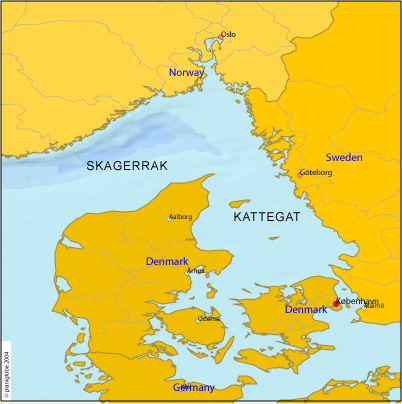
- Outlets of the Baltic Sea to the Atlantic.
- Credits
- Source: http://www.planiglobe.com
Licensing[edit]
| This image is from Planiglobe. All maps hosted on Planiglobe are licensed under the Creative Commons Attribution 2.5 License, but Planiglobe suggests that they not be used for navigational purposes. For the purposes of this license, this clause is considered a disclaimer and not a license restriction. This file is licensed under the Creative Commons Attribution 2.5 Generic license.
|
File history
Click on a date/time to view the file as it appeared at that time.
| Date/Time | Thumbnail | Dimensions | User | Comment | |
|---|---|---|---|---|---|
| current | 08:57, 8 October 2005 | | 402 × 404 (88 KB) | ToB (talk | contribs) | '''The North Sea''' (Skagerrak and Kattegat, the sea area between Norway, Sweden and Denmark) :'''Source:''' http://www.planiglobe.com Category:Maps of seas |
You cannot overwrite this file.
File usage
Global file usage
The following other wikis use this file:
- Usage on az.wikipedia.org
- Usage on ba.wikipedia.org
- Usage on de.wiktionary.org
- Usage on et.wikipedia.org
- Usage on gd.wikipedia.org
- Usage on hy.wikipedia.org
- Usage on kk.wikipedia.org
- Usage on ru.wikipedia.org
- Usage on simple.wikipedia.org
- Usage on sr.wikipedia.org
- Usage on tt.wikipedia.org