File:Skypark of Scotts Valley aerial view.jpeg
Jump to navigation
Jump to search

Size of this preview: 800 × 410 pixels. Other resolutions: 320 × 164 pixels | 640 × 328 pixels | 1,024 × 525 pixels | 1,280 × 656 pixels | 2,560 × 1,312 pixels | 4,653 × 2,384 pixels.
Original file (4,653 × 2,384 pixels, file size: 3.81 MB, MIME type: image/jpeg)
Captions
Captions
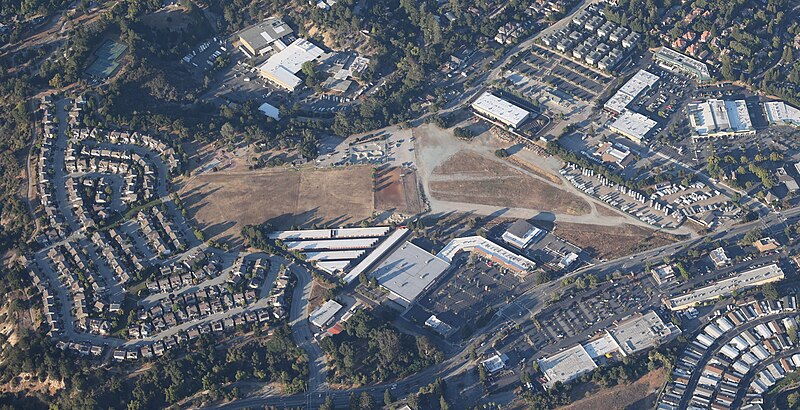
Aerial view of Skypark city park in Scotts Valley, 5,500 ft, from the west, with surrounding residential and commercial neighborhoods. Remnants of the old airport are visible on the right side of the park.
Summary[edit]
| Description | Skypark of Scotts Valley (aerial view) |
| Date | |
| Source | Own work |
| Author | CriticalAngleOfAttack |
Licensing[edit]
I, the copyright holder of this work, hereby publish it under the following license:
| This file is made available under the Creative Commons CC0 1.0 Universal Public Domain Dedication. | |
| The person who associated a work with this deed has dedicated the work to the public domain by waiving all of their rights to the work worldwide under copyright law, including all related and neighboring rights, to the extent allowed by law. You can copy, modify, distribute and perform the work, even for commercial purposes, all without asking permission.
|
File history
Click on a date/time to view the file as it appeared at that time.
| Date/Time | Thumbnail | Dimensions | User | Comment | |
|---|---|---|---|---|---|
| current | 02:01, 19 July 2021 | | 4,653 × 2,384 (3.81 MB) | CriticalAngleOfAttack (talk | contribs) | {{Information |Description=Skypark of Scotts Valley (aerial view) |Source={{own}} |Date=2021-07-16 |Author= CriticalAngleOfAttack |Permission= |other_versions= }} |
You cannot overwrite this file.
File usage on Commons
There are no pages that use this file.
File usage on other wikis
The following other wikis use this file:
- Usage on en.wikipedia.org
- Usage on www.wikidata.org